Słownik K
Geography Maps Slownik Geograficzny Slownik K
Slownik Geograficzny Translations
Kacwin (now Kaczvin, Hungary)
Kacwin - in the County of Slovan, Hungary
The village is near Spisz in the district of Niedzica. In German it is Kacvin and in Hungarian it is Kaczvin. It is on the river Kacwin at the mouth of the Dunajec located in a wide valley that is enclosed on both sides by the North Magora (Spisz). Kacwin was also known as Kacwink, originally as Katzwinkel and Katzenwinkel. It already existed in the 13th century. It is only known that the owner Kokosz in the year 1320 sold the territory Frydman (near Niedzica), Kacwin, and Frankowa to his brother Jan and his son Michael for 100 grzywien. The Roman Catholic parish was established in 1278 but it was not known when the church was built. The church’s name is “All Saints” and the registers date from 1679.
In 1880 the village had 940 people: 832 Roman Catholics, 1 Greek Catholic, 14 Jews, and 93 non-Uniate (Greek Orthodox). There are two chapels: Holy Trinity and Saint Ann. The post office is in Starawies. The church is at an elevation of 561 m. From the west are the hills Krzyzona (Krizowa Hora) with an elevation of 767 m, Kunia Hora is 780 m, Winterleit is 723 m, Sklad 825 m, and from the east Halzyna 734 m and the hill Czerbulski is 743m. Br[onislaw] G[ustawicz].
Source: Slownik Geograficzny Królestwa Polskiego - Warsaw [1882, vol. 3, pp.650-51]
This translation is used by permission.
Kadzidło
Kadzidło 1.) a church-owned village in Ostrołęka county, Dylewo gmina [district, township], Kadzidło parish. It is situated in the midst of the old Myszyniec Forest, and is inhabited by Kurpies. It has a wooden parish church and an elementary school. The church was founded in 1780 by Antoni Nalecz Malachowski, the Royal Grand Secretary, starosta of Ostrołęka; an older church was founded in 1740 by Antoni's father, Jan Malachowski. A chapel in Dabrówka also belongs to this parish. In 1827 there were 91 houses and 515 inhabitants here; currently it has 116 houses and area of 2,510 morgs. Kadzidło parish, in Ostrołęka deanery but formerly in Mława deanery, has 8,525 souls. Formerly today's parish of Lipniki also belonged to Kadzidło parish.
2.) Kadzidło or Kadzidła, a village in Luków county, Prawda gmina, Stoczek parish. It has 6 houses, 61 inhabitants, 150 morgs of area.
2.) Kadzidło or Kadzidła, village powiat/district Łukowo, gmina/township Prawda, parafia/parish Stoczek. It has 6 houses, 61 inhabitants, 150 morgs of area.
Source: Slownik Geograficzny Królestwa Polskiego - Warsaw [1882, vol. 3, p.664]
This translation, by Krzysztof Sobiech, edited by Fred Hoffman, is used by permission.
Kakolówka
Kakolówka, a long village on the Strug, which flows from the right bank into the Wislok, and located on the Rzeszów-Dukla highway. The village, surrounded by coniferous forests, has two outlying hamlets, Newsie and Wola, and belongs to the Roman Catholic parish in Blazowa, 1 km. away. The population of 1,896 Roman Catholics works in agriculture, as well as weaving and home industry. According to a memorial submitted to the Galician administration in 1882 there were-140 weavers' shops here. They use factory-made yarn from Silesia or handmade from Gródek, but have little of their own, because they maintain that the soil is exhausted and thus cultivating flax doesn't pay. They sell good products, some locally, some in Kraków, Lwów, and even in Moldavia. Some of the finest work is even said to come back from Romania to Galicia as Romanian or Turkish goods. There is a one-class people's school here. The major estate, owned by Wl. Skrzynski, has a total area of 283 mórgs of farmland and 1,365 of woods; the minor estate has 1,470 mórgs of farmland, 192 of meadows and gardens, 166 of pastureland, and 230 of woods. See also Izwor and Kamienny potok. - Mac.
Source: Slownik Geograficzny Królestwa Polskiego - Warsaw [1882, vol. 3, p. 940]
This translation, by William F. Hoffman, first appeared in the Winter 2000 issue of "Bulletin of the Polish Genealogical Society of America".
Kalwarya
- a farmstead in the 4th police district of Oszmiana province [ed.- near Wolozyn]. Lying 28 miles from Oszmiana, it contains a single home with 49 inhabitants of whom 35 are Orthodox and 14 Catholic (1866). [now in the Grodna/Hrodna region of Belarus]
Kalwarya- a provincial town in Suwałki gubernia on the Szeszupa River, lying at 54°23.8'N latitude and 22°54.1' E. The town is 204 miles from Warsaw, 27 to Suwałki, and 11 miles from Marianpol. It lies on the high-road from Warsaw to Suwałki, Kalwarya, Marianpol to Kowno. The nearest railroad station on the Warsaw- St. Petersburg line is on the branch to Wierzbolowa at Kozlow Rudzie. Kalwarya has a Catholic parish church, an affiliate Protestant (Evangelical) church, a brick synagogue, provincial government building, a civil court of the 3rd district belonging to the Suwałki circuit, a gmina court, post office and international telegraph station, St. Jerzy's hospital with 25 beds, a prison with a Catholic chapel, and a grammar school. The annual town revenues are around 7,000 rubles. In 1827 there were 501 homes and 5,438 inhabitants; in 1861 521 homes (46 of brick) and 8,432 inhabitants (of which 6,687 were Jewish). The most recent population count shows 500 homes and 8,936 dwellers. The Christian population is engaged primarily in agriculture and gardening, with the Jews handling commerce. Concerning industry, no major factories are known, although there are three small breweries generating an annual revenue of 3,152 rs. and small copper manufacturing cottage industries producing 1,200 rs. annually. The Catholic parish was founded there in 1715 by Prince Korybut Wiszniowiecki; the brick church was erected more recently in 1840. Locational privileges were granted to the town by (Polish king) August II and confirmed by King Stanislaus Augustus in 1791. Originally, other "Calvary" towns were distinguished there, namely a Jewish "Calvary". The famous scientist and Polish ancient historian W.A. Maciejowski was born there. Kalwarya parish (in the Kalwarya province dekanat) has 8,144 parishioners. The town sheriff's jurisdiction in the Voivodship and Trocki province is composed of the town of Calvary and its surroundings. Up to 1766 it was owned by Michael and Alexandra Oginski, Voivod of Wilno.... [partial translation]
Kalwarya- a village about one mile from Werek, in the 1st police district of Wilno province, lying on the right bank of the Wilija River. The present Catholic church was converted from a Dominican monastery on March 20, 1675, by Stephen Pac (or earlier by George Biallozora in 1664?). Surrounding the church are 33 brick chapels with representations of the Passion of Christ. Visiting crowds gather at dawn on feast days of the Holy Trinity and Holy Ghost. In 1866 the village had 3 homes and 14 inhabitants.
Kalwarya- 1) a magnificent ancient cemetery in the Minsk gubernia, having a brick church possessing inside the well-known paintings of Jan Damela. The remains of many great persons from the town and the surroundings rest there. 2) an inn for country travelers about half the distance between Borisov and the Nieman villages.
Kalwarya- (German: Kalvaria or Calvaria)-- a farmstead at Radzyn situated near the town, in Grudziąsz province, with a Catholic parish, school and post office at Radzyn. Originally it was a property of the town, but was voluntarily ceded to the Teutonic Knights at their request. Through Grand Master Conrad of Thierberg, it was registered in 1285 as St. George parish and the Holy Cross castle chapel for the betterment of the Knights; it enclosed about 240 acres. It acquired the name "Calvary" not only from the Stations of the Cross there, but also the Passion of Christ roadside shrines and figurines placed there, to which processions marched from the castle chapel. At present, the Passion figures are still there. In 1582, the bishop of Chelm, Peter Kostka, annexed Kalwarya to the local town parish, St. Anne, with which it still remains. This location does not show up in recent (geographical) indexes, (except perhaps) on military maps.
Editor's Note: All Slownik longitudes in this article have been converted to modern coordinates which is based on the Greenwich zero meridian. All Polish measurement units (land areas, distances, height above sea level, etc.) were converted to American-English equivalents. Monetary units, where identified, were left in zlotys/zl. or rubles/rs.
Source: Slownik Geograficzny Królestwa Polskiego - Warsaw [1882, vol. 3, pp. 711-712]
This translation, by Mike Gansecki, is used by permission.
Kalwarya Zebrzydowska
Kalwarya Zebrzydowska-- a town in Wadowicki province on the Widenski high-road, 14 kilometers east of Wadow, 19 kilometers to the southeast of Mogilan, and 38 kilometers to Krakow 38 kil... [ed.-- a famous shrine located in southwestern Poland, but not translated further here...].
Source: Slownik Geograficzny Królestwa Polskiego - Warsaw [1882, vol. 3, pp.712-715]
This translation, by Mike Gansecki, is used by permission.
Kalwarya żmujdzka
Kalwarya żmujdzka (Samogitian Calvary)- a government town in Telszew province on the Wardawa River. It lies 17 miles from Telsze, and has an annual market fair from July 8 through July 12. A brick Catholic parish church was built there in 1642 by Bishop Jerzy Tyszkiewicz and it was a Dominican monastery in the interim.. [partial translation].
Editor's Note: All Slownik longitudes in this article have been converted to modern coordinates which is based on the Greenwich zero meridian. All Polish measurement units (land areas, distances, height above sea level, etc.) were converted to American-English equivalents. Monetary units, where identified, were left in zlotys/zl. or rubles/rs.
Source: Slownik Geograficzny Królestwa Polskiego - Warsaw [1882, vol. 3, p. 712]
This translation, by Mike Gansecki, is used by permission.
Kalwaryjka
Kalwaryjka- "Little Calvary", a village in Grojecki province, Katy gmina, Sobikow parish.
Source: Slownik Geograficzny Królestwa Polskiego - Warsaw [1882, vol. 3, p.716]
This translation, by Mike Gansecki, is used by permission.
Kalwaryszki
Kalwaryszki- a small farmstead, located in lovely picturesque surroundings several miles from the western border of Minsk gubernia on the Swisloch river. Formerly the property of Hausman, then in 1866 that of the Antropow family, and later the Czarykow family, it possesses a beautiful summer villa. Minsk residents visit the location by walking or negotiating the water with canoes. Al. Jel.
Source: Slownik Geograficzny Królestwa Polskiego - Warsaw [1882, vol. 3, p.716]
This translation, by Mike Gansecki, is used by permission.
Kamionka
4) Kamionka, hamlet in Komorów, in the county of Kolbuszowa, Roman Catholic parish in Ostrowy Tuszowskie, distance from the post office in Majdan, about 4 kilometers.
Source: Slownik Geograficzny Królestwa Polskiego - Warsaw [1882, vol. 3, p. 782]
This translation, by Anthony Paddock, is used by permission of the author.
Karpa
Karpa, a settlement in Augustów county, Barglów gmina and parish. It lies 16 versts [17 km.] from Augustów and has 1 house and 1 inhabitant. [No author named].
Source: Slownik Geograficzny Królestwa Polskiego - Warsaw [1883, vol. 4, p. 854]
This translation, by William F. Hoffman, first appeared in the Fall 2002 issue of "Rodziny, The Journal of the Polish Genealogical Society of America".
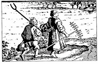
Kaszuby Drawing of a Kaszub couple in working clothes, by T. Rousseau, reproduced in Atlas polskich strojów ludowych: Strój Kaszubskie, by Bozena Stelmachowska; provided by Sophie H. Knab.
Kaszuby, in German Kassuben, Kaschuben, Kaschubei, in documents Cassubia, Cassubitae, the name of a region and people in West Prussia; it is not certain what the name comes from, whether from kasanie hub [fold, pleat] (a term still used for fald [fold, pleat]), or from kaszuby, which in Pomerania means "fairly shallow water overgrown with high grass." At one time the clans of the Pomeranian princes came from the Kaszuby region. It was originally quite extensive, covering all of Pomerania that is now Germanized. In the mid 13th-century the princes of eastern Mecklenburg signed their names as "duces Cassubitarum" ["leaders" or "dukes" of Cassubitae]. Currently belonging to the Kaszuby region, however, is the northwestern portion of Chojnice powiat, almost all of Koscierzyna powiat (not counting an eastern band near Skarszewy, Zblewo, and Lubichowo), all of Kartuzy and Wejherowo powiats, and the northwestern part of Gdansk powiat, and finally a few remnants in the Germanized districts of Bytów and Lebork. To the north Kaszuby extends to the Baltic Sea, the Bays of Puck and Gdansk; to the east it borders on the territories of the Zulawiaks and Kociewiaks; to the south live the Borowiaks; and to the west lies Germanized Pomerania. There are no really large rivers or streams in Kaszuby; still the rivers and streams there are numerous and swift-running, issuing mostly from lakes. The more important are: the Brda, Czarna Woda (in its origins), Wierzyca, Wietcisa, Radunia, Slupa, Slupianka, Strzelniczka, Leba, Czarna, Reda, Chylonia, Strzysza, and many others. Lakes are very numerous, including: Wdzydze, Suminskie, Peplinskie, Wielskie, Koscierskie, Radunskie, Gowidlinskie, Zarnowskie, and others almost beyond counting. Stretching through the center of Kaszuby from east to west is the Ural-Baltic Ridge (German name Ural-baltischer Landrücken) with the highest elevations in the hills of the Szymbark area (1,020 m. above sea level). These hills divide Kaszuby into two parts, northern and southern.
The soil of southern Kaszuby is for the most part sandy, watery, and stony; only rare breaks entertain the eye with golden wheat and green meadows. Before there was a highway there, a well-off father bringing his son back from vacation in Chojnice would harness three spry steeds, and take along several spare ropes just in case, for in the sand one could not cover more than 21 km. in 5 hours, and the wheels often sank up to the axle in the loose element. The ordinary farm-owner considered such a trip too hard on his harness. So the poorer peasants would usually set out on foot. If it weren't for the lakes and their fish, the inhabitants would have to forsake their patches of sand, for the soil would not support them. Besides withered rye and small potatoes, the fields are covered at best only with white buckwheat, from which the Kaszub has his beloved porridge, which for him stands in for all other dishes. He may have some bread he's bought, and he entertains guests under his thatched roof only on holidays. Small villages are rare here, too, with meager buildings, and they are usually located on water, on which the inhabitants go without care in their small canoes hollowed out of logs.
It is more cheerful in northern Kaszuby. The soil there, though cold, is more fertile, sometimes black, and is densely populated. Hills and valleys of all kinds make for variation. If we stand on some high point east or west, we have before us a landscape which other regions famed for their beauty might envy us. Dark forests usually enclose the field of view, in which green fields, lakes shining gold in the sun, narrow bands of small, swift-flowing rivers and brooks contrast with small villages, usually hidden on the water in valleys. This part is rightly called Szwajcarja Kaszubska [Swiss Kaszuby], namely, the beautifully situated vicinities of Wejherowo, Kartuzy, Zukowo, Chmielno, the Szymbark hills, Zarnowiec, Oliwa on the sea, etc. Alongside the large and medium-sized estates there are small farms here, the largest a hundred mórgs. But the peasant is comfortable, even affluent. In the forest it is no rarity to find wild boars rooting; when one emerges to feed on peas and oats, it is felled more often by the peasant's bullet than the forester's. Farther on, where the hills do not approach the sea, unfathomable peat bogs stretch from Oliwa almost to Puck, the source of a fair-sized profit. In the Bay of Puck and the sea, and in the larger lakes, people work as fishermen. From there salmon, flounder, and eels are sent for fast-day meals to Torun, Gdansk, and Warsaw, and unsalted herring goes to nourish the natives. In the forest they gather mushrooms and berries, which they bring to town. They also burn coal, and rework wood for farm use. But most often they work in the fields.
In form the Kaszub is not tall; he is bony, nimble, of rather fair complexion, usually with light-colored hair. The men's clothing consists of a long, pleated frock (of homespun), with firm calf s leather shoes, often tar-soaked, and pants, also of homespun, reaching down to their tops. Currently the most typical feature of every Kaszub's attire is a large cap (like the ones firemen wear), covering the back of the skull, and the ears with flaps; gray sheepskin is sewn on the front, and the inside is also lined with sheepskin. They used to wear a tall sheepskin cap with short silk ribbons, usually yellow, on the back. Young Kaszub women also delight in warm homespun dresses with similar ribbons. In summer they wear on their heads a thin white scarf knotted under the chin-thus they are called bialki ["white ones"].
The Kaszub is jolly and free, and if he's been drinking, he would give his neighbor all he has. But when you get on his bad side, he is obstinate and uncompromising, which is the source of a proverb, "Uparty jak Kaszuba" ["stubborn as a Kaszub"J. It is hard to find any real anger in him. Only one thing has ever really gotten to him, and that was the Order of the Teutonic Knights; when a Kaszub wants to revile someone in the coarsest of terms, he will shout at him "Te kómtorze!" ["You Knights commander!"] (he also calls the toad komtur). He receives guests cordially and treats them to whatever he can. Formerly at weddings and baptisms drinking-bouts were common; but now after the Jesuit fathers' missions, an exemplary sobriety and industry is the rule. This is a most pious people, they besiege the famous Wejherowo kalwarye by the thousands; they also make pilgrimages in hordes to more distant holy places such as in Laki, Gietrzwald, etc. Their churches are always overcrowded, although their parishes, like rural dioceses, are widely dispersed. The Kaszub is an avid learner, and many Kaszub sons are educated in gimnazjums in Wejherowo, Peplino, Chelmno, and Chojnice. In general the boys distinguish themselves in school with their persistent work, and quite often with their quick talent.
One can distinguish here three types of szlachta. The most ancient pure-blooded Pomeranian or Kaszub nobles, who can usually be recognized beforehand by their short surnames ending in -a, survive in fairly large numbers in the powiat of Kartuzy and in Pomerania, as far as to Slupsk. Among them were the families of Jarka, Pyrcha, Wnuk, Janta, and many others. Their inheritances are not large. Another kind of nobles, the zagonowa [roughly equivalent to "yeoman" in English] are densely settled in Kartuzy and (northern) Chojnice powiaty, and come from the cavalry officer's aides who supposedly received arms under Jan III Sobieski at Vienna. The third kind consist of Polish families who moved to Prussia in large numbers in the 16th and 17th centuries, endowed with extraordinary privileges, especially exemption from the levy en masse beyond the borders of the country. The first and the third have become greatly Germanized. Among the towns, Koscierzyna has most preserved a Kaszub character; that is why it is called the capital of Kaszuby. Next comes Wejherowo, more recently founded, which has recently become more Germanized. Other towns formerly Kaszub, such as Puck, Lebork, Bytowo, Slupsk, Leba, and to some extent Gdansk, are now almost entirely Germanized.
To this point only one railway line crosses Kaszuby, the Gdansk-Slupsk line at Oliwa, Wejherowo, and Lebork. Currently they are building another, secondary one from Pszczólki to Skarszewy to Koscierzyna and Bytów. Efforts are also being made for a similar line from Zukowo to Kartuzy, but so far the prospects are not good. Highways are somewhat more densely located.
In order to get at least an approximate idea of the number of the Kaszub population, the best way is to look at the parishes in which Kaszubs live, for to be a Kaszub is to be a Catholic; in general there are few German Catholics among the Kaszubs. Kaszub is first and foremost the entire deanery of Puck, with the parishes of Jastarnia, Mechowo, Starzyn, Wejherowo, Góra, Oksywie (Chylonia), Puck, Rumia (Reda), Swarzewo, Strzelin, Tulowo, and Zarnowiec; the total of souls here is over 27,000. The second deanery, Koscierzyna or Mirachowo, includes the following parishes: Koscierzyna, Kartuzy, Chmielno, Gorecin (Kielpin), Gowidlino, Stare Grabowo (Reknica), Lipusz, Luzino, Parchowo, Sianowo, Sierakowice, Stezyca, Strzepcz, Sulecin; that is over 43,000 souls. Lebork deanery, with the parishes of Ugosc, Bytowo, Niezabyszewo, Lebork, and Rozlazin, has over 6,000 souls. Scattered in other deaneries are the Kaszub parishes of Zukowo, Przodkowo, Maternia, Oliwa (partially), Kielno, Chwaszczyno, Kiszewa, Wiele, Legno, Brusy, Borzyszkowy, for a total of over 43,000. So the whole Kaszub population totals about 120,000 souls, a number that would be rather too low than too high, inasmuch as the above reckoning is done according to diocesan summaries from 1867 (obviously after having discounted non-Kaszubs), and recently the numbers of the population have increased everywhere.
The Kaszub language differs significantly from contemporary Polish, although experts say that it is one of its most primeval forms. This language, like the whole people, is rapid and lively in nature. The accent usually falls on the syllable farthest from the end. The Kaszubs themselves divide themselves in terms of pronunciation into Lasaks and Beloks. The former, in the south near Koscierzyna, speak more firmly; the Beloks, near Wejherowo and Puck, cannot pronounce ł. Considerable variety in pronunciation predominates in various towns. Medial y and other vowels are most often pronounced as e: Peck (Puck), reba (ryba, "fish"), grepa (grupa, "group"), Slepsk (Slupsk). Palatalization is almost totally unknown, so they say czetac (instead of czytac, "to read"), cetka (instead of ciotka, "aunt"), pisac (instead of pisac, "to write"). In endings they drop the e in -ek: pask (instead of pasek), matk (instead of matek, from the word for "mother"), ojc (instead of ojciec, "father"). They have preserved the old dual in the forms pójdma, pójwa (instead of pójdzmy, pójdzcie, "let's [both] go, you [both] go"). They have also preserved many almost unknown terms, e. g., czechlo, czechel (grave clothes), gunia (a garment of coarse material), lez (lie), plesz (tonsure), pleszok (priest), plesze (dots or eyes on potatoes), nekac (to drive cattle into the fields), molnia chlaszcze or chlasta (a dry, glossy shine), etc. Despite all that, a Kaszub understands a Pole very well, and reads Polish books (almost every one, because they study alone at home; at school they have long since been Germanized); they even take it ill if a Pole speaks to them po "kaszebsku" (in Kaszubian). They like to read Polish periodicals, especially when exhorted to do so by their pastors, most of whom, unfortunately, have been Germans, and not the best. In the single parish of Mechowo, with a not over-large population, they keep 78 copies of the rather heavily written Pielgrzym.
In recent times Kaszuby has become rather famous. First and foremost, Dr. Cejnowa began to collect anecdotes, proverbs (not always Kaszubian), songs (many flirtatious and almost unknown); they were printed in small brochures under the title Skorb kaszebskje move [Treasury of Kaszubian]. In Poznan Rev. Gustaw Poblocki published Slowniczek mowy kaszubskiej [A Small Dictionary of Kaszubian]. A kind of Kaszubian epic was written by the well known Hieronim Derdowski, entitled O panu Czorlinscim co do Puck po sece jachol, Torun 1880. See also the dissertation of Rev. Kujot in Warta, a collective work, Poznan 1874. A. Helferding has also written a lot about Kaszuby. See his Collected Works (in Russian), Petersburg 1868-73, volume 3. Also Seidel, "Das Land und Volk der Kassuben" [The Land and People of Kaszuby], Neue Preuss. Provinzialblätter, 1852, vol. 48. [Rev. Fankidejski]
Source: Slownik Geograficzny Królestwa Polskiego - Warsaw [1882, vol. 3, p. 904-907]
This translation, by William F. Hoffman, first appeared in the Spring 1999 issue of "Bulletin of the Polish Genealogical Society of America".
Kaszyce
Kaszyce. A peasant village in the Wilejka district; it is situated 69 viorsts from the city of Wilejka; 3 administrative precincts; in the Gruzdowo community; 17 houses; 188 residents (1866).
Kaszyce, a village on the Kaszyce stream which is the San river tributary on the left bank; in the Jarosław district; the village has the Roman-Catholic parish and a standard school building ; Greek-Catholic residents belong to the parish in Zamiechów. 680 people reside on the territory of 40 morgs which belongs to the major estate; 8 Greek Catholic residents, 12 Jews, other inhabitants belong to the Roman Catholic Church. The major estate, which is held by the heirs of M. Górski, has 403 morgs of farmland, 56 of meadows and gardens, 17 of pastureland and 62 of forest; the minor estate has 450 morgs of farmland, 58 of meadows and gardens and 25 of pastureland. Fabroniusz of Pantalowice and his son Spytek founded a chapel which was built in Kaszyce in the year of 1555. The chapel was intended to be the branch of the church in Pantalowice. When the Gorajski family took possession of the village, they adopted the Helvetian religion and the chapel was adapted to serve the purpose of their house of prayer. When Krzysztof Gorajski converted to Christianity he sold the chapel to Stanisław Zboski who was a bishop in Przemyśl. Stanisław Zboski consecrated the chapel in 1683. The chapel regained its status of being the branch of the church in Pantalowice. The chapel ceased to be the branch in 1742 when I. Ch. Szembek, who was a bishop in Przemyśl, transformed it into the parish church. A new church was built in 1741. It was made of wood and it still remains in Kaszyce. Kaszyce is bordered by Zabłocie in the east, by Tapin in the west, by Zamiechów in the north and by Dmytrowice in the south.
Kaszycki Potok (The Kaszyce stream) a tributary of the San river; refer to Kaszyce ( II )
Source: Slownik Geograficzny Królestwa Polskiego - Warsaw [1882, vol. 3, p.907]
This translation, by Jaromir Iwanciow, is used by permission.
Kcynia, in German Exin, in old documents it is also known as Krcenia, a city in the powiat of Szubin. The village of Kcynia is located in a hilly region, on one of the highest points in the Grand Duchy of Poznań. Because the surrounding ground is lower the city is often exposed to the winds; the soil in the area is a thick clay like substance, under which is found a layer of gravel. In the area beneath Kcynia there is neither flowing or standing water and there are few water wells ; therefore in the summer a shortage of water often occurs; there are four communities in addition to Kcynia Miasto (The City of Kcynia): Kcynia-settlement and three granges: Karmelin, Stahlberg and Wydartowo. In the year 1871 there were about 254 houses, 2,618 inhabitants, 605 Protestant, 1,528 Catholics and 8 of other Christian beliefs and 477 Jews. In the year 1875 there were only 2,591 inhabitants. In Kcynia, there were the headquarters of the district and also a Customs Office. The Catholic Parish Church was in the deanery of Kcynia. The Protestant Church was in the Dioceses of Szubin. A synagogue also existed in Kcynia. There was a Catholic Seminary for the future teachers with a preparatory institute and an elementary school "kilkoklasowa" (Editors Note 1). There were 645 illiterates. Trade and commerce at Kcynia has been lively over the ages, it is in present times more modest in dimension, dealing in horses, cattle and cereal grains. An important occupation in the area is the manufacture of pottery because of the availability of good clay in the region. For this same reason there are brick works in the town and in the region that produce brick and clay drain pipes. Located here is a Post Office of the second class and a telegraph; a postal service center for the area "poczthalterya"(Editors Note 2), personal mail from Nakło passed through Kcynia for Wagrowiec, and from Kcynia for Gniezno; as did written mail for Gromadno and for Retkowo; There is a Railroad Station in Nakło (Nakel), 18 km distant. In the year 1811, Kcynia had 243 houses and 1411 inhabitants; in the year 1831 about 214 houses and 1834 inhabitants; in the year 1837 about 2074 inhabitants. From April 1842, there were four two day fairs: with stalls for horses and cattle. Apart from the Parish Church, consecrated to St. Egidius and funded by Wladyslawa Herman (1079-1102), there is still in existence a second church with an old Monastery of the Carmelite monks and a chapel containing a miraculous painting that attracts many pilgrims. In the year 1262 Boleslaw, Duke of Wielkopolska granted a charter to Kcynia under the Madgeburg laws: the city administered an area from Poznań to Gniezno. In Kcynia during the 13th century Dukes Boleslaw and Przemyslaw of Wielkopolska negotiated with their uncle Swietopełk Duke of Pomerania a treaty to be able to regain the castle at Nakło and control of the area to Poles. In times past Kcynia was the capital of the powiat (district) under the jurisdiction of the general of Wielkopolska. It was also a place of annual Calissian nobility meetings. Resided also at Kcynia a "starosta niegrodowy" a kind of district leader. In the year 1441 a great fire destroyed the whole city; Almost all of the houses were rebuilt of stone, but by the 18th Century the area was in a state of decline. Raczynski in his Memories of Wielkopolska (II p. 392) mentions the city in the 16th century and its considerable commerce. When in the year 1594 Sigismund (Zygmunt III) Vasa returned from Sweden he passed through the area, in Kcynia trade and craftsmen asked him to guarantee their profits from business, endangered by Scottish craftsmen who settled in the area. In the year 1772 the city came under Prussian dominance. Kcynia, as a district of the Calissian voivodship, was a center of political, administrative and judicial authority for the area, according to the lists from the year 1661 the city encompasses: Kcynia, Miesciska and the villages of Demblowo, Borzatew and Wiela. In the year 1771 after Andrzej Mielzynski and Anna Bnińska were Kcynia's "Starosta"s, Kazimierz Radonski, a Colonel in the Army, was. He paid so-called "quarter-tax" of 410złoty and winter-tax "hyberna" of 473 złoty and 6 groszy. After the creation of a Governor for Gniezno province, Kcynia was included in the provincial administration of this area. About the year 1765 there were 1928 Jews in the province of Kcynia. M. St.[udniarski]
Editors Note 1: The term "Kilkoklasowa" refers to village / city elementary school with more then one class. When there were 5 or 10 children of school age and one teacher in small settlement, only one class have may have been organized with various exercises that concerned of the age of school child; the multi-class school was something bigger and better.
Editors Note 2: The term "Poczthalterya"- postal service stand; it is less then post office, usually managed by civil inn-owner; it was a stopping station for rest, food and horses or stagecoaches on postal routes.
Source: Slownik Geograficzny Królestwa Polskiego - Warsaw [1882, vol. 3, p.947-948]
This translation, by Jim Piechorowski and Wiktor Karpowicz, is used by permission.
The village lies on the brook Lepietnica. Five kilometers directly southeast of the village is Nowy Targ. It has a border with Obidowa on the northeast, on the south with Lasek and northwest with Sieniawa and Rdzawka (in the county of Myslenice). Klikuszowa from southeast to southwest stretches almost 3km.
The larger estate has 36 Austrian morg of farmland, 5 in fields and gardens, in pastures and 35 in forests. The smaller estate has 1003 of farm land, 165 Austrian morg of fields and gardens, 351 in pastures and 71 of forest. The owner is Konrad Fihauser.
The village has the following population:
Year Houses People
1777 94 451
1799 101 556
1824 112 584
1869 132 714 (352 men and 362 women)
1880 684
The records of the Tarnow Archdiocese in 1880 lists 710 people, and in 1882 lists 700 Roman Catholics.
On the east side of the village is the hill Skalka (822 m in elevation) that ends west at the Gorce Hills. On the eastern border is the brook Klikuszowa.
The village already existed in 1234 under the name” Klikuszowa” belonging to the foreman of Nowy Targ and before that to Radultow and to the cloister in Szczyrzyc. Documents from 1636 indicate 20 stockyards, 1 hut, a few rooms for the working farmers (no count was taken), and a local administrator. The total taxes that year were 277 zolty and 24 groszy. In 1660, documents indicate 12 stockyards, 1 mill and a local administrator. And in 1765, the documents indicate 15 farms, 8 fenced gardens, 2 mills and a local administrators Samuel and Simon Szprwinski. The total taxes were 1512 zloty and 26 groszy. The local administrator’s position existed in 1536, and the present administrator was imprisoned for 3 years.
The records of 18 October 1772 indicate that the mansion and farm buildings were destroyed and there was a mill with one rock, a sawmill, and a tavern turned into a house. The land areas included in the village were: Rabica, Pasiek, beyond the mill Okrag and Janow; fields: Mala and Wielka Bukowina, Tyn, Rosule, Solisko, Spalone and Obidowiec. The Rabica forest was destroyed. In 1824 Klikuszowa contained the following areas: Niwa, Obidowa, Lasek, Morawczyna, Pyzowka, Pieniazkowice, Dzial, Odrowaz, Dlugopole and Zaluczne. There is a wooden Roman Catholic church built in 1753 named for St. Martin the Bishop; the parish is affiliated with Nowy Targ. The records of the church started in 1786. A new concrete church was built in 1878. The villages belonging to the parish are Lasek, Morawczyna, Obidowa, and Pyzowka. There are 3036 Roman Catholics and 29 Jews. There is a school with one classroom and one teacher. The post Office is in Nowy Targ. Klikuszowa is famous for hunting thrush. Br[onislaw] G[ustawicz].
Source: Slownik Geograficzny Królestwa Polskiego - Warsaw [1883, vol. 4, p.145-46]
Klimaszewnica
Klimaszewnica, a village on the river of the same name, in Szczytno county, Bialaszewo gmina [district] and parish. It is surrounded on three sides by marshes, the waters of which are drained off by the river Klimaszewnica to the Biebrza (river). The village is only somewhat more accessible from the south, and on that side is connected by a paved road with Karwowo. In 1827 there were 50 houses, 307 inhabitants; at present there are 72 houses, and land of 1,571 mórgs [about 2,181 acres].
Source: Slownik Geograficzny Królestwa Polskiego, Warsaw [1883, vol. 4, p. 146]
This translation, by Mark Kaszniak and edited by William F. Hoffman, is used by permission.
Klimkówka
Klimkówka – a village in the county of Sanok, which remains under the jurisdiction of the head of the county in Sanok. The county court is in Rymanow which also claims the post office. It has 150 homes and 1000 people. The residents are Catholic, although it was formerly for the German nationals. It was colonized here since the time of King Jan Kasimierz. Presently they speak and think Polish and are merely in name acknowledging their foreign origin. The area of the manor is owned by Teofil Ostaszewski of Wzdowa. The settlement here has 350 morgs of fields, 124 morgs of meadow and gardens, 19 morgs of pasture, and 458 morgs of forest. The estates have 861 morgs of fields, 93 morgs of gardens, 137 morgs of pasture, and 2 morgs of forest. The farm, as well as, the land of the manor, is progressive and model farms, for which the wealth of the peasants here is well known and is growing with every day. The land was increased by additional drainage several years ago which doubled the harvests greater than before. Also here are a distillery, brick works, and drainage works all maintained by the owner. The estate has beautiful orchard, which provide fruit to market to the entire area. The pears of Klimkówka are famous for their quality and well known as an article of trade in the area. Klimkówka is a marginal village in the county of Sanok on the western most boundary of the township is Iwonicz, which is already on the county line. Through Klimkówka flow the streams of Kellarow and Jarosow, which join here to form the Kompacha, which will eventually flow into the Morawa. The land is wet but fertile, becoming marshy on the northeastern boundary of the village, with Ladzin and royal Wroblik. It has an elevation of 315 meter above sea level. The highest point is Sucha mount, on the west side of the Wulka, at 608 meters above sea level. Klimkówka lies on the tract at the base of the Carpathian Mountains between Rymanow and Krosno. The Latin parish is in this place and belongs to the deaconate of Rymanow, to which in addition to Klimkówka belong also Balucianka and Wola. The charter to erect a parish here disappeared in the XVI Th century when the present Klimkówka came under the influence of the Reformation. In the records of the Bishop from 1567 it was noted that the benefits that were in effect currently, because of the heretics was vacated. So the record books of that time date from its dedication here in 1453 under the patronage of St. Michael, and dedicated by Nicholas Blazyowski, Bishop of Przemysl, who also founded the parish. This was to have taken place at the beginning of the XV Th century. During the visit of Fredrowski in 1728, he admitted that the church was founded on the birthday of Bobola, Chamberlain of Przemysl. They give his reformation in the end of the XVII th century. Presently the wooden church dates form 1854 and was dedicated (blessed) in 1869, again under the patronage of St. Michael. In the cemetery is a brick chapel and sacramental in the ogival style, supposedly built of brick by Teofil Ostaszewski, according to the plans of Teofil Zebrawski. Under the Chapel are the graves of the Ostaszewski family.
Source: Slownik Geograficzny Królestwa Polskiego - Warsaw [1883, vol. 12, p. 148]
This translation, by Jerry S. Kucharski, FIC, FICF, is used by permission.
Kłoniczno
Kłoniczno, also Kłączno, German Klonczen or Klontzen, a village in Bytów powiat, referred to in documents as Klonych, in Pomerania. At the beginning of the 15th century it was owned by Janusz Kwiatoszyc ("Hannos Quettoschitz"). In 1428 Teutonic Knights grand master Paul von Russdorf exchanged with him for this village (Male Kłoniczno), which then had 17 wlókas, and gave him 12 wlókas in Czarna Dabrowa, in addition to 4 mórgs of marsh (a peat-bog) in Klipy, under terms of Magdeburg law. In return Janusz served in war on a horse valued at 6 marks, answering every summons, helping erect new castles and tear down old ones; he also contributed 1 pound of wax, and 1 Chelmno pound of plow-tax [?fun. chelm. pluznego], and 1 bushel of oats. In 1487 Kłoniczno had 10 wlókas of land, five of which were empty, each taxed at 8 skot., and an inn paying 2 marks, for a total of 1 mark 16 skot. per wlóka, and 7 posków [? - even the author didn't know what this was] of mead. In 1658, before the war, Stare Kłoniczno had 1 soltys and 6 gburs, the soltys served in the war on horseback [Translator's note: the war referred to is presumably the war with Sweden, 1655-1660]. After the war there was 1 gbur with 2 horses and 1 cow, and the other places were empty. In 1662 the soltys paid 150 florins on 2 cultivated wlókas -and 3 empty ones, and the gburs paid 6 florins per wlóka. The two nobles no longer performed any castle service. At that time the soil was described in writings as sandy; there was no hay, although the village lies near Lake Kłoniczno. There is a patch of primeval forest about 7.5 km. wide and 15 km. long, stretching from Sumin to Oslowa Dabrowa; it produces no revenue, although coal merchants pay several zl. from it. There is also a large pine forest, stretching from Ugoszcz to Studzienice and Czarna Dabrowa. Oaks and beeches grow in it; there is food there for 360 hogs. On-site is a Catholic school, and there are more than 220 Catholic faithful, of Ugoszcz parish. Cmp. Przewóz.
Source: Slownik Geograficzny Królestwa Polskiego - Warsaw [1883, vol. 4, p. 188]
This translation, by William F. Hoffman, first appeared in the Fall 1997 issue of "Bulletin of the Polish Genealogical Society of America".
Klonówka
Klonówka, German Klonowken, in 1565 called Renkieczkie in documents, a knightly estate in Starogard [Gdanski] powiat, in a beautiful site on the Wierzyca river, which makes numerous bends here and has steep banks surrounded by woods. Klonówka includes the farmsteads of Mosty, Najmusy and Marywil, which belong to the estate; it covers an area of 5,363 mórgs, with 497 Catholic and 8 Protestant inhabitants, and 37 houses. It has a parish church and school, a large garden with a park, and a new manor; the post office is in Pelplin. The distance from Starogard is 1 mila [about 7.5 km.], to Pelplin half a mila.
We know nothing from any source about the founding of this village and its first charter. However there is no doubt that it is a very old settlement; this is attested by, among other things, a pagan burial-ground located by the village. In the southwest side of the village, in the woods to the left of the road to Barchnowy, many stone circles were torn down at various times. There are also numerous common graves of stone and isolated urns in Klonówka. In 1887 one circle still existed, but it too was partially damaged. See Ossowski's "O wspomnieniach przedhistor. Prus król." [On prehistorical memories of Royal Prussia] in the first yearbook of the Towarzystwo Nauk w Toruniu, p. 37, and the same author's Mapa archeolog. Prus zach. [Archeological map of West Prussia], pp. 23, 46, 82.
From its beginning this village was a royal estate. Subsequently, due to hard times in the 15th century, it was apparently pawned to the Czarlinskis, who along with their descendants claimed the rights of ownership. There is an interesting entry on this in Krzysztof Czarlinski's summary of incomes, in which Klonówka with its monetary rents and fiefs and farmstead was appraised at 446 florins, 8 pence. But during an audit of this village a royal decree issued at the Sejm was produced, saying: "Czarlinski, Renkieczkie, 11 March, Pawel and Jurek Czarlinski produced a grant of lifetime tenure to the village of Renkieczkie from the late King Zygmunt to Stanislaw Czarlinski, given accordingly that he ceded to His Majesty the king a second village of his tenancy, Wunthal (?), both of which villages he held previously in lifetime tenure for a thousand zloty's bequeathed to the kings by his ancestors. This letter testifies to the lifetime tenure, a new one cannot be made. The Czarlinskis are to return to the first possession and tenancy what their ancestor was to hold for redemption before receipt of the lifetime tenure. As regards improvements to the village, such as the mill they had built at their own expense, this also they will hold with the villages for redemption. Nothing will be held out from the Commonwealth or His Majesty, for everything beyond the redemption of the pledge will come to His Majesty." See the copy of the summary in Peplin. The auditors' protest was effective in that long afterward Klonówka is still numbered among the royal estates.
The local proprietors, all nobles without exception, call themselves tenants or leaseholders of Klonówka, as did, for instance, the tenant Czarlinski in 1580, and before him Hieronim Buczynski, Sieradz starosta. In 1686 Wolf was the tenant of Bar. Ludwik Luddinghausen. In 1719 Maryanna Kosowa née Wolf, wife of the Chelmno Palatine, increased the number of wlókas belonging to the pastor, and her brother, Jerzy Kazim. Wolf, dean of the Warmia chapter, renovated the church. In 1732 Maryanna Rychtarska née Kalkstein held Klonówka. In 1740 it was Maryanna Pawlowksa née Kalkstein, her husband was Jan Pawlowski, Mirachowo judge. Around 1760 Jerzy Kalkstein, Chelmno standard-bearer, acquired the property of the village of Klonówka. In 1780 Jerzy Kalkstein, Chelmno chamberlain, owned Najmusy, Mosty and Marywil as well as Klonówka. In 1789 Maryanna Pawlowska née Kalkstein, wife of the Michalowo judge, bequeathed legacies to the church in Klonówka. The current owner is Michal Kalkstein.
The church in Klonówka has existed for a long time, and the 1867 diocesan summary writes of its condition. The parish church in Klonówka, called St. Catherine's, is of private patronage, and it is not known when it was founded and consecrated. Next to it is a shelter for three poor people. The parish numbers 1,678 souls. The villages served by the parish are: Klonówka, Mosty, Lipinki, Rywald, Brzezno, Nowydwór, Debina, Najmusy, Marywil. There are four parochial schools: one in Klonówka with 62 Catholic children, one in Rywald with 84, one in Brzezno with 68, and one in Nowydwór with 52. Rev. F[rydrychowicz]
Source: Slownik Geograficzny Królestwa Polskiego - Warsaw [1883, vol. 4, p. 161-162]
This translation, by William F. Hoffman, first appeared in the Summer 1997 issue of "Bulletin of the Polish Genealogical Society of America".
Kolbuszowa, Kolbuszowa Dolna, Kolbuszowa Górna
Kolbuszowa: 1) county seat [miasto powiatowe] in Galicia, lies in a wooded and sandy region, on the river of the same name; it has a rather large pond and is surrounded by pine forests. It is a tidy-looking town, comprised mainly of wooden residences which show white amid the greenery of beautiful orchards and gardens; for this reason it looks like an oasis in the middle of a sandy wasteland. In addition to the stone church on the town's west side, noteworthy are the elegant buildings of the major estate, and farther south a rifle-range, powder-magazine, brewery, brickyard, and a windmill on a slightly elevated spot. As Kuropatnicki tells in his Geografia Galicyi, in the 17th century there was a famous palace here, beautifully constructed, all of wood with headless nails wrought by the local ironworkers; but in the course of time it deteriorated and was finally torn down on the order of Count Jerzy Tyszkiewicz. The famous Kolbuszowa transaction took place here in 1753, that is, the distribution of the lands of the Ostróg estate in tail by the last heir, Prince Janusz Aleksander Sanguszko, Lithuanian marshal; this became a sort of national affair in that it provoked a number of quarrels and lawsuits and created an uproar in several Sejm's, until it was finally confirmed by a 1766 enactment. Also to be found here was a fortified castle, destroyed in 1769 by members of the Confederation of Bar.
This town is better known, however, for the industry of its residents; for it is a manufacturing community of ironworkers, carpenters, wheelwrights and lathe-operators, who at one time sold their goods throughout all of Galicia, Poland, and Lithuania. Their products-namely tables, beds and boxes-caught the attention of Rohrer during his journey through Galicia in 1804 (Bemerkungen auf einer Reise durch Galizien). He felt that these craftsmen could produce far more beautiful objects if only they had proper models. Due primarily to competition from carpenters in larger cities, especially Viennese factories, and even more to the lack of cheap and quick transportation, this industry limited itself to producing objects that met the needs of the peasants, and to wooden utensils.
Despite this Kolbuszowa has remained the same as it ever was. It has 3,262 inhabitants, of whom 151 live on the major estate. In terms of religion there are 1,275 Roman Catholics and 1,987 Jews. Kolbuszowa is the seat of a starostwo and the offices connected with it, also of a powiat council and court. It has a four-class elementary school and a pharmacy. Two doctors of medicine and two surgeons have their permanent residence in Kolbuszowa. The Rzeszów-Baranów-Tarnobrzeg highway leads through the town, and a second highway leads from the town west to Raniszów. [Translator's note: this probably refers to the town of Ranizów, except it lies east of Kolbuszowa].
Kolbuszowa was part of the Ostróg estate in tail, then belonged to the Lubomirski princes, and currently the major estate is the property of Count Zdzis. Tyszkiewicz. The major estate has 279 mórgs of farmland, 93 of meadows and gardens, 33 of pastureland, and 10 of forests; the minor estate has 539 mórgs of farmland, 41 of meadows and gardens, and 221 of pastureland.
The stone parish church dates from 1312. In addition to it there is also a chapel named for St. Stanislaw in the public cemetery. The parish belongs to the Diocese of Tarnów, Mielec deanery, and with its 13 affiliated localities has 9,616 Roman Catholics and 1,987 Jews. Two suburbs of the town have the names "Konczówka" or "Klodniczówka" and "Podosobnia." In Okolice Galicyi on page 99 M. Steczynski gives a description and sketch of the south side of Kolbuszowa. The city charter was granted in 1690; see Dod. do Gaz. Lwow., 1861, Nr. 25. See also "Powiat Kolbuszowski" in Holowkiewicz's "Wedrówki po kraju," Przewodnik nauk. i liter., 1878, p. 211.
Kolbuszow county [powiat] stretches over sandy plains, and to the west it borders on Mielec county, to the south Ropczyce and Rzeszów counties, to the east Lancut county, and to the north Tarnobrzeg and Nisko counties. It covers 87.586 kilometers and has 63,866 inhabitants in 65 settlements and 61 cadaster gminas. The two powiat courts in Kolbuszowa and Sokolów belong to this county.
2) Kolbuszowa Dolna (including Lowczówskie and Lesnictwo), a village in Kolbuszowa county, 2 km. north of the town, with 1,258 Roman Catholic inhabitants. The major estate, belonging to Count Z. Tyszkiewicz, covers 181 mórgs of farmland, 14 of meadows and gardens, 40 of pastureland, and 20 of forests; the minor estate covers 881 m6rgs of farmland, 168 of meadows and gardens, 203 of pastureland, and 13 of forests. The village has a gmina loan society with a capital of 997 zl. r.
3) Kolbuszowa Górna (including Sedziszówka and Wojkowo), a village in Kolbuszowa county, 2 km. south of the town, with 1,619 Roman Catholic inhabitants, a one-class elementary school, a gmina loan society with capital of 1,195 zl. r., and a distillery on the lands of the major estate. The major estate, belonging to Count Zd. Tyszkiewicz, covers 570 mórgs of farmland, 64 of meadows and gardens, and 69 of pastureland; the minor estate covers 1,606 mórgs of farmland, 274 of meadows and gardens, 429 of pastureland, and 49 of forests. Both these villages lie alongside the highway and belong to the Roman Catholic parish in the town of Kolbuszowa. Mac.
Source: Slownik Geograficzny Królestwa Polskiego - Warsaw [1883, vol. 4, pp. 259-260]
This translation, by William F. Hoffman, first appeared in the Spring 1997 issue of "Bulletin of the Polish Genealogical Society of America".
Komarówka
Original text:
Walewskiego podaje: " wieś i folwark, powiat radzyński, gmina Żelizna, parafia Komarówka, mają 20 domów, 220 mieszkańców, 910 morgów ziemi (według innych źródeł 53 domy i 646 mieszkańców). Pozycja płaska, ziemia pszenna kl. II, gospodarstwa płodozmienne, gorzelnia. Plac przed kościołem w czworobok zabudowany (...). Leży przy trakcie z Parczewa do Międzyrzecza (sic!). Parafia łacińska Komarówka należy do dekanatu radzyńskiego, dawniej międzyrzeckiego i liczy dusz 924 (1876 r. - 924) ".
2) village and farm, Radzynska district, commune Żelizna, parish Komarówka are 20 houses, 220 inhabitants, 910 acres of land (according to other sources, 53 houses and 646 inhabitants.) Position a flat, ground wheat class II, holding płodozmienne, distillery. The church square is built in the quadrangle (...). It is situated at the Parczew do with Mesopotamia (sic). The Komarówka Latin parish belongs to the deanery radzyńskiego, formerly Miedzyrzecki and counted 924 souls (1876 - 924).
Source: Slownik Geograficzny Królestwa Polskiego, Warsaw [1883, vol. 4, p. 306]
This translation, by Donald Szumowski, is used by permission.
Koprzywnica
1) settlement, formerly a small town, on the river Koprzywianka, in Sandomierz powiat [county], in the gmina (district) and parish of Koprzywnica. It lies on the elevated edge of the valley of the Vistula, which is 7 verst away [about 7.5 kilometers], in a mountainous region. It is about 15 versts [about 16 kilometers] from Sandomierz, 98 versts [about 105 km.] from Radom, and 195 versts [about 208 kilometers] from Warsaw. It has a brick parish church, and an elementary school. In 1827 there were 171 houses and 1,051 inhabitants here; in 1860 there 150 wooden houses, 1,266 inhabitants (275 Jews); at present 153 houses (2 brick), 1,519 inhabitants, with 914 mórgs [about 1269 acres] of land belonging to the townsmen. The Population is employed with crafts, mostly shoemaking.
Kopzywianka owes its existence to the Cistercian abbey which was founded here about 1185 by Mikolaj Bogorya, the voivode of Sandomierz, as is attested by a tablet with an inscription, kept here all this time, as well as a charter issued by Boleslaw the Bashful1 in 1277, which renewed the previous endowment. In 1241 Tatars plundered the church and settlement, and killed the population. As a result of this, Boleslaw the Bashful, in charters issued in 1262 and 1277, broadened the previous privileges and endowments and increased the previous liberties for both the monks and the settlement’s inhabitants. Wladyslaw Lokietek2 granted the settlement a town charter based on German law3, which Kazimierz the Great4 confirmed during his presence in Koprzywnica in 1360. He stayed here a second time in 1370, resting in the monastery for eight days after a hunting accident. Subsequent kings confirmed and expanded the town’s liberties. In August of 1606 there was a meeting of the nobility called by Mikolaj Zebrzydowski, the voivode of Kraków, who headed the opposition and the so-called rebellion; sixteen senators took part in this meeting, and King Zygmunt III5, who was staying in Wislica at the time, negotiated with them to restore peace.
Koprzywnica’s own parish church no longer exists, but supposedly was built in 1180 by transforming a duke’s hunting manor, or a storehouse for fishing nets. Its construction was striking for the inefficiency of technique and conception. When it fell into ruin, it was closed in 1821, and both services and the parish were transferred a former church of the Cistercians, whose order was dissolved in 1819. All that remained intact was the chapel of the Mother of God, built in 1693. The Cistercians' church and monastery is located outside the city, on the grounds fo the village of Cegielnia. It has preserved to this day its original features on the inside, and partially on the outside. Built with cut stone and in the in shape of cross, its architecture is reminiscent of all the Cystercians’ other buildings from that time. The nave is divided by two lines of pillars into three parts; the ceiling is cross-shaped. Traces remain of paintings from the 13th century in the galleries joining the church and the monastery. The monastery buildings are in ruin; one that stands out is the chapter-house of cut stone that dates from the 12th century. There have been alterations due to renovations that destroyed so many monuments and did great harm to the local buildings. In the 17th century, only the main peaked wall was changed, and the original shape of the tower (in shape of goblet turned upside down) was raised. It was built by the last abbot, Krzysztof Bogorya Skotnicki. The church grave vaults, five in number, are neither ancient nor interesting. The most ancient is of the brothers Niedrzwicki from 1581, any another is of a certain Otfinowski from the 17th century, erected by the brothers Samuel and Waleryan Otfinowski. The church and the monastery’s buildings were examined and described by professor Luszczkiewicz. See "Pioneers of Gothicism in Poland" (Ateneum from 2nd quarter, year 1882).
Koprzywnica parish, Sandomierz deanery, has 4,999 souls. Koprzywnica gmina [district] with an office in the village of Cegielnia, has 5,121 inhabitants, 648 houses, with an area of 10,948 mórgs [about 15,196 acres] including 5,047 [about 7,005 acres] of manorial land; the gmina court, district III, is in Loniów, and the post office is in Sandomierz. The gmina includes: Bieszyce dolne, Bieszyce-górne, Blonie, Cegielnia, Cissyca duchowna, Dmosice, Gnieszowice, Kamien-wislocki, Koprzywnica, Krzcin, Krzcinska-kepa , Nagnojowska-kepa, Niedrzwica, Przewloka, Radowaz, Sosniczany, Speranda, Swiezyca, Trzykosy, Wielkoleka, Zarzecze and Zbiegnowice. There are a quarry for building stone, 6 mills, an oil mill and a brickyard. In the gmina there are 5 lakes with about 37 mórgs (about 51 acres) of area.
2.) Koprzywnica, a manorial farmstead on the river Koprzywianka, in Sandomierz powiat [county], in the gmina [district] and parish of Koprzywinca, 620 mórgs [about 861 acres], 8 houses, 13 inhabitants, and a water mill. It is the entailed estate6 of general Chruszczew. The Koprzywnica prebend has an area of 216 mórgs of land [about 303 acres], without buildings, the entailed estate of Aleksander Hurko.
1 Boleslaw the Bashful, Polish king 1243-1279
2 Ladislaus the Short, Polish king 1306 – 1333
3 Casimir the Great, Polish king 1333 – 1378
4 a charter defining terms on how towns were incorporated based on German law
5 Zygmunt III Vasa, Polish king 1587 – 1632
6 “entailed estate” is a legal term referring to an estate with specific limitations on who can inherit it.
Source: Slownik Geograficzny Królestwa Polskiego, Warsaw [1883, vol. 4, p. 384]
This translation, by Mark Kaszniak and edited by William F. Hoffman, is used by permission.
Kornalowice
Kornalowice (Rusyn: Kornelowyczi), A village in the Samborsk district, 12 kilometers northeast from Sambor, 12 kilometers northwest from the District Court in Łaka, and 6 kilometers North-West from the postal, train and telegraph station of Dublany-Kranzberg. Surrounded by Hordynia to the East, Dublany to the South-East , Kulczyce to the South-West, Krużyki to the West, Kalinów (al. Kaiserdorf) to the North-West, and Koniuszki Sieniawskie (in the Rudeck district) to the North-East. The Dniestr River runs from the West (from Krużyk) to the East (to Hordynia) in the southern part of the area, together with a few insignificant streams feeding to the river from the right side. The right shore of the Dniestr River encompasses farm buildings and a brick-yard; fields and pastures are to the South from them, and the Liski Forest to the South-West. The highest hill is 313 meters tall. The left shore of the Dniestr River (283 meters to the West, 1279 meters to the East) is occupied by the Michałówka Manor, followed by farm lands and pastures farther North, and extensive marshlands (Sechownice), elevated to 276 meters on the South side and declining towards the Strwiąż valley to the North. The run-off water from the marshlands flows North to Strwiąż. The Greater Estate of Celestyn Sozański contains 790 mórgs of farm land, 598 mórgs of meadows, 179 mórgs of pastures, 710 mórgs of forest, 101 mórgs of gardens and building lots, and 39 mórgs of wasteland; The Smaller Estate contains 751 mórgs of farm land, 627 mórgs of meadows, 293 mórgs of pastures, and 12 mórgs of forest. The soil very fertile, heavy black soil on the left shore of the Dniestr River, light clay on the right shore with a “7- field crop” rotation system. According to 1880 records, there were 1210 inhabitants in the township and 138 in the estate (662 Roman-Catholics, 640 Greek-Catholics, 46 Israelites). Men wear black wool cloaks with green stripes and black hats; in the summer, instead of cloaks they wear white linen jackets. In the winter, women wear black or navy blue overcoats with black astrakhan fur lining, crimson pants and heads covered by crimson scarves with a few feet of white linen on top, so called “prymitki”. In the summer, they also wear black woolen “żupan” [Polish noblemen’s national dress]. Living conditions of villagers are more than bad. Most buildings are shoddy wooden huts covered with thatched roofs. The inventory of the greater estate includes 251 of “berneńska” breed cattle, 121 horses; the inventory of the smaller estate includes about 350 cattle and same horses. The Roman-catholic parish is in Dublany, while the Greek-Catholic parish is in Hordynia. There is an Orthodox church and a single-class school in the village. The school building was built on the right shore of the Dniestr River between 1878 and 1880. It houses an 8-meter long by 6-meter wide classroom and a teacher’s apartment with two rooms, a kitchen and a pantry. Lectures are in Polish. The school was attended by 85 boys and 32 girls in 1882. 30 children repeated classes. There is a distillery and a water mill in the village.
Above details were provided by Ms. Karolina Sielińska. Lu. Dz.
Source: Slownik Geograficzny Królestwa Polskiego - Warsaw [1883, vol. 4, pp. 404-405]
This translation, by Regina Frąckowiak, is used by permission. All other rights are reserved.
Kossaki
Kossaki, aristocratic neighborhood in the former land of Łomża, Kossakowski family seat, was given in 1436 by Fr. Władysław Mazowiecki. Within this area were lying K.Borowe, K. Falki, K. Nadbielne, K. Ostatki and K. Ponikły Stok. Currently there are only:
1) K-Borowe, noble village, Łomżynski powiat, Kossaki gmina, Kołaki parish, is 933 mr. area. The Kossaki gmina office is in the village of Kołaki, there are 5,248 people, there are 16,407 mr. of land, s. gm. okr. IV Kołomyja, the post-office is in Zambrów, 4 water mills, a windmill and a brick factory, the beginning of the second school. The gmina includes: Cholewa-Kołomyja, Czachy-Kołaki, Czarnowo-dąb, Czczedruckie zalesie, Czosaki-dąb, Cwikły, Dębniki, Duchny-welony, Głodowo-dąb, Gosie, Górskie-ponikłystok, Grądy-Woniecko, Hunie-Ostrów, Kalinowo-basie, Kalinówka, Kołaki-kościelne, Kołomyja, Kołomyjka, Kosaki-borowe, Krusze-łubnice, Łętowo-dąb, Mężenin, Modzele-górki, Olszewo przyborowo, Podłatki-leśniewo, P.-małe, Rębiszewo, Rutki, Sanie-dąb, Szlary-ciżmo, S.-łopienice, S.-mieszki, Undy-Czarnowo, Walechy, Wiszniówek-wertyce, Wróble-jarciszewo and Zanie-leśnica. The gmina is mostly populated by nobles with the above mentioned village only having 5 peasant inhabitants, while 2 others have a mixed population.
2) K.-Ponikły, noble village on the Narew river, Łomżynski powiat, Drozdowo gmina and parish. Farm K. Ponikly-slope of attynencya Kosaka v. Baskets-Zaborowo, extensive mr. 781;arable land and gardens mr. 305, meadows mr. 69, mr pastures. 42, water mr. 14,Forest mr. 311, wastelands and yards. 40. Bud. wood. 20. 11-field crop rotation.Brickyard, layers of peat. Village Kossak-Ponikły-slope sediment 40, the ground mr.160.
3) K., noble village, Łomżynski powiat, Puchały gmina and parish. It has 513 morgs of land.
4) K-turki, Kolneński powiat, Jedwabne gmina and parish (see). In 1827 there were 8 homes and 46 inhabitants.
5) K., noble village, szczuczyński powiat, Lachowo gmina and parish. In 1827 there were 16 homes and 93 inhabitants.
6) K., mixed peasant and Noble village on the Bug river, ostrowski powiat, Nur gmina and parish. In 1827 there were 13 homes and 86 inhabitants.
Source: Slownik Geograficzny Królestwa Polskiego - Warsaw [1883, vol. 4, p.469-470]
This translation, by Donald Szumowski, is used by permission.
Kotowa Wola
Kotowa Wola, a village in Tarnobrzeg county, belonging to the Roman Catholic parish in Zaleszany and to the county court and post office in Rozwadów. It lies in a plain 155 meters above sea level, on the stream Osia, which flows from the right bank to the Łęg river in the area between the confluence of the Wisla [Vistula] and San rivers. On the west, east, and south the village is surrounded by pine forests. Of the 606 inhabitants, 46 live on the grounds of the major estate, owned by Fr. Popiel, which has 371 mórgs of farmland, 128 of meadows and gardens, 83 of pastureland, and 833 of forests. The minor estate has 219 mórgs of farmland, 149 of meadows and gardens, and 179 of pastureland. The district savings society has a capital of 160 zl. in Austrian currency. Kotowa Wola is bordered on the north by Zaleszany and Zbydniów, on the east by Turbia, on the south by Jamnica, and on the west by Zabrnie, a settlement on the outskirts of Grebów. Dr. Jachno collected mollusks in the vicinity of Kotowa Wola.-(Mac. (Dr Maurycy Maciszewski], Vol. IV, p. 32).
Source: Slownik Geograficzny Królestwa Polskiego - Warsaw [1883, vol. 4, p.32]
This translation, by William F. Hoffman, first appeared in the Summer 2002 issue of "Rodziny, Journal of the Polish Genealogical Society of America".
Kozowa
A small town in the Brzezany district, situated on the edge of the Podole region and on the river Koropiec, which emerges from the Podole meadows and is a tributary of the Dniester. It covers an area of 6852 morgs (morg = 1.5acres). The underlying turf land has not, as yet, been exploited. The town has a population of 3,641 and is made up of 862 families with 1,817 male and 1,824 female residents. There are 1,510 Roman Catholics, 803 Greek Orthodox and 1,328 Jews. The district court for 33,524 inhabitants is in the town, the regional court is in Zloczow and the district main finance office is in Tarnopol. The State Seym and the district court are approximately 2 Austrian miles away in Podhajce. Members to the People’s State Council are elected from Brzezany and the district court, Brzezany. The Roman Catholic and Greek Orthodox parishes are in the town. The former is made up of the following parishes Helenkow, Kalne, Krzywe, Litiatyn, Sloboda, Szczepanow, Telacze, Teofipolka, Uwsie and Wiktorowek: the latter of the villages Helenkow, Teofipolka, and Wiktorowek. The population is part Ruthenian, part Masurien, and has been here for a long time. They speak Polish and Ruthenian and are only to be distinguished by their religious practice. The 3-class school has 3 teachers, 2 of whom are females. Very few of the older generation can read or write and presently 240 children are attending school. Agriculture on the peasant land is of a very low standard however, the manor lands look much better due to the presence of a brewery. The manor lands include 2,223 morgs of arable land, 218 morgs meadow, 836 morgs pasture and 282 morgs woodland. The smaller parcels of arable land cover 3,063 morgs, 267 meadows and 69 pastures. Although the land is relatively fertile, grain is grown more for its straw than its seed. There are no factories apart from the brewery. And as far as trades are concerned, the only one worth mentioning is pottery. The only business is the collection of grain from the peasants by the Jewish population and a few market stalls selling the basic commodities. The Brzezan-Tarnopol road passes through the middle of the town situated 2 miles from Brzezan and 5 miles from Tarnopol. The nearest rail station, from Karol Ludwik´s reign, is in Zborow, 5 miles away. 11 fairs take place each year and on Thursdays there is a weekly market, selling agricultural produce, local products and livestock, in particular the hornless. The church was founded in 1669 by Andrzej Potocki, the Kiev voivode. Earlier the small castle was fortified and the seat of the Moszynski family who were the owners of the Kozow key. A number of small villages and the town of Zawalow also belong to it. Today it is the district court and home of the judge. This small town has belonged to the Szeliski family for a number of years now.
Source: Slownik Geograficzny Królestwa Polskiego - Warsaw [1883, vol. 4, p.573]
This translation, by Jola Jurasinska, is used by permission.
Krajenka
Krajenka, in German Krojanke, in documents Krainka, in 1420 Kraina, in 1453 Crayna and in 1676 Kroganick. A town, peasant-owned village and farmstead in Zlotow county, in the region called Krajna. It lies on the stream Glumia [now called Glomia] at the point where the stream Kocun flows into it, on the highway between Zlotow and Wysoka (to the Grand Duchy of Poznan). It lies about 9 km. from Zlotow.
1) The town covers an area of 12,477 mórgs; it has 1,057 buildings, 417 houses, with 755 Catholics and 1,874 Protestants. In the town there is a Catholic parish church, a Lutheran parish church, a Jewish synagogue, municipal co-educational school, post office, train station, telegraph office, town hall, county physician, brewery, 5 bakers, 6 coopers, 5 butchers, 2 glass-works, 1 forge, 1 furrier, 2 tanners, 1 painter, 13 shoemakers, 16 tailors, 11 blacksmiths, 1 rope maker, 2 saddlers, 4 locksmiths, 5 wheelwrights, 6 potters, 1 cloth factory, 12 carpenters, 2 weavers, 1 dyer, and a water mill with a fullery. There are 7 government-recognized guilds, for millers, carriage builders and coopers, carpenters, blacksmiths, shoemakers and saddlers, tailors and potters. Guildmasters gave examinations to 48 students between 1861 and 1865. There are four annual fairs, for cattle, horses and market stalls. Earlier the city was known for cloth production, and as late as 1805, the income from cloth production amounted to 2,876 thalers. Also belonging to the town were 8,203 mórgs of woodlands; in 1865 the income from them came to 10,525 thalers, with expenditures of 2,476 thalers, for a profit of 8,058 thalers.
2) The village and farmstead: the farmstead by itself covers 2,996 mórgs, the village 491 morgs. In all there are 54 buildings, 15 houses, with 74 Catholics and 139 Protestants. On the farmstead there is a distillery, which in 1863 paid the government 2,259 thalers in duties.
Krajenka is among the oldest settlements in the whole area. From time immemorial a road from Sierock to Gdansk has run through the town. Some people maintain that Krajenka is the Skurgon mentioned by Ptolomeus, but this seems rather unlikely. In terms of its location it is like a Krajna [cut-off area] within the region called Krajna, divided on all sides -- or cut off -- by streams and rivulets (that is, at one time it was); the names Krajna and Krajenka come from the verb odkrajac, “to cut off.” The stream Glumia flows north, and in the south a rivulet flows from Slawianowo to the forest of Zelgno (German name Seestrang). Flowing from the east is the stream Kocun, and from the west there is an old canal running almost parallel to the Kocun, which joins the Glumia and the rivulet at Slawianowo.
Initially Krajenka stood behind the castle and the castle church, on the other side of the Glumia, toward Sokolnia and Woytownica, and belonged to the wealthy Danaborski family, which took its name from the family estate, Danabórz, in the Krajna region. During the times of Polish rule it was annexed to the Naklo starosta’s jurisdiction. Jedrzej Danaborski, the Kalisz voivode, is the first owner in 1336 of whom we find anym ention. Waclaw, the Naklo castellan, appears in 1338. In 1420, Maciej Danaborski, the starosta of Naklo and later voivode of Inowroclaw, moved the town to its present location and granted a new charter, which King Wladyslaw Jagiello confirmed (in Geschichte des Kreises Flatow Schmitt wrote that this was Andrzej, but this is surely wrong; after all, Maciej had already succeeded in 1409). Supposedly before then only the village was called Krajenka, but that is not certain. Around 1460, Wladyslaw Danaborski (also called Wlodko), the son of the voivode Maciej and of a certain Raciborz princess of the royal Piast family, was one of the wealthiest magnates of his time. In addition to the family estate of Danabórz and land at Bialosliwie, he owned a great many estates in the Krajna and Paluki regions. In 1461, King Kazimierz Jagielonczyk gave him in gage the town of Frydlad, and the whole area under the jurisdiction of the Naklo starosta. The Czluchow and Tuchola castles were also given him as security. For quite some time the Danoborski family at Naklo castle had possessed considerable sums. In 1465, he joined forces with the Crusaders against the King and could have proven very dangerous. However the Polish army forced him to surrender in time, and he begged the King’s forgiveness on bended knee. His daughter, Katarzyna Danaborska, the granddaughter of Princess Raciborz, married Maciej Tuczynski (von Wedel), heir to Tuczno. In 1499, Waclaw Danaborski, the Bydgoszcz castellan, was the owner of Krajenka. In the mid-16th century, Gerussa Danaborska, also called Gertruda, was mentioned as the heir to this estate. She was married to Jan Koscielecki, voivode of Sieradz, General of Great Poland and starosta of the Bydgoszcz, Naklo and Drawsko regions. He was a man who did much for his church and country; Hozyusz praised him highly during the reign of King Zygmunt August. He died in 1569.
Krajenka, the Danabórz estate near Krajenka, Niezuchowo, and other properties came to the possession of the house of the Koscieleckis. The family also received large sums of money designated for Naklo. There is a letter written in 1569 by the aforementioned widow of Jan Koscielecki, Gerussa Danaborska, who wrote from Krajenka to Cardinal Hozyusz to recommend to him her son, Andrzej. Niesiecki writes of this Gerussa that she was already the wife of Jan Koscielecki around 1450; but this is a mistake, as is obvious from the contents of this letter. Another son of Gerussa, Stanislaw Koscielecki, heir to Krajenka, was also the starosta of Naklo; but after his death King Stefan took the Naklo starosta’s lands away from this house. From that point the Krajenka estate remained in the hands of the Koscielecki family for about 100 years. In 1652 the person died who was apparently the last member of this family, Anna Koscielecka. Her first husband was Iwinski, and then she married Stefan Grudzinski, courtier to the Polish kings Zygmunt, Wladyslaw and Jan Kazimierz. He fought in many wars.
It was through Stefan that the Krajenka lands became the property of the Grudzinski family, which already had other Zlotow properties. Zygmunt Grudzinski, the Kalisz voivode, is mentioned around 1623 and 1638, and was married to Anna Opalinska, whose daughter, Isabella, married Pawel Dzialynski, the voivode of Brzesc Kujawski. In 1650 Andrzej Karol Grudzinski, heir to Krajenka, was the voivode of Kalisz, and later of Poznan; he was the son of Zygmunt and Izabela Opalinski. In 1663 he granted a new charter to the local guilds. He lived until 1683 and died heirless.
Then it was surely the Dzialynskis, who were related to them, that acquired this property. In 1688, Maciej Dzialynski, heir to the Krajenka and Zlotow estates, the son of the Kalisz voivode Zygmunt, grandson of Izabela Dzialynska nee Grudzinska, departed this world without having ever married. His brother Jan Dzialynski inherited the property from him; he died in 1695 and his widow, Ludwika Los, received this estate as a lifelong possession. In 1714, the heir Jozef Dzialynski, son of Pawel, the brother of the previously mentioned Dzialynskis, Jan and Maciej, established the position of promoter of the rosary in Krajenka; he bequeathed money and land for its upkeep. Jakob Dzialynski inherited the Krajenka estate after Jozef. It was during his time, in 1721, that the local Lutheran congregation was destroyed; this same Jakob funded the construction of a new Catholic parish church. In 1732, Jozef Dzialynski issued the town a new charter allowing the citizens to brew beer. They had only to pay 5 tynfs for every 9 bushels of malt, and deliver 4 pails of small beer from every brew to the castle. They paid 100 tynfs on spirits.
In 1766, Duke Sulkowski was heir to Krajenka and patron of the church. In 1779, after the occupation, a new Lutheran church was built, and in 1787 a parish was established with it. During the Prussian era Krajenka was acquired first by Count von Flottow, a great favorite of Prussia’s King Friederich. After him the Sulkowski family once again became its owners. In 1774 Duchess Sulkowska built a new parish church in place of the temporary one built under the Prussians. It was made entirely of brick, for the most part taken from the old castle. In 1805, Krajenka belonged to the Komierowski family, followed by Meyer Wulff Liepmannsohn. In 1820, it came under the ownership of the royal Prussian family. Its owners were, in turn, Wilhelm III, Wilhelm I when he was a prince, and then Prince Karl.
The parish of Krajenka numbers 1,376 souls. It is not known when the Church of St. Nicholas, under the patronage of the Prussian Prince Karl, was built. The present-day church was built in 1774 and consecrated in 1775. There is a shelter for 3 paupers attached to it; it has had a Brotherhood of St. Anne since 1663, and Brotherhoods of the Rosary and of Sobriety since 1859. The pastor is Antoni Friedrich. The parish villages are Krajenka, Smierdowo, Pieczyn, Annafeld, Wegierce, Lesnik, Hamer, Tarnowka, Piecewo and Osowka. The Catholic schools are in Krajenka, a 2-class school with 164 Catholic children attending; and in Smierdowo, with 57 children. 22 children attend the Lutheran school in Pieczyn, but no attempt is being made to teach them lessons in religion. There used to be another church besides the parish church, namely St. Catherine’s, as well as a Chapel of St. Anne in Krajenka. The church of St. Catherine was located outside the town; it was small, built of brick, and along with the paupers’ shelter formed the so-called “provostry”; patronage over this facility was the prerogative of the heirs to the estate. The pastor was allotted three wlókas of land, and one was allotted to the hospital. The manor house in Konarzewo supplied clothing for the poor in the shelter, and the manor house in Krajenka provided firewood, one wagon per person. Services were held here for more than ten years after a fire in 1688 destroyed St. Anne’s parish church in town. After the occupation the provostry of St. Catherine’s deteriorated rapidly, and in 1829 it was torn down by order of the police. St. Anne’s Chapel also lay outside the town. After the parish church and the rectory been burned down in 1688, the pastor at the time, Jan Gorczynski, the Kamien canon, erected a temporary residence by the chapel. Other than that we know nothing about it, and it hasn’t existed for a long time. Before the Protestant Reformation and Prussian occupation there were still 3 other Catholic churches in Krajenka parish: in Ossowka, Tarnowka and Piecewo. [Rev. Fankidejski].
Source: Slownik Geograficzny Królestwa Polskiego - Warsaw [1883, vol. 4, p.580-582]
This translation, by Jolanta Jurasinska, edited by William F. Hoffman, is used by permission.
Krerowo
1) Is a village in the county of Sroda, having 23 dwellings and 214 inhabitants, all of which are Catholic with 50 illiterate. The Catholic parish church belongs to the deaconate of Sroda. The post office is located in Wegiersk about 6 kilometers away and the telegraph and railway station is in Sroda about 8 kilometers away. This village previously belonged to the estate of the Bishop of Poznan, with which Jan IV of Kepa funded the parish church in 1344. More valid memorials of the past are not in the church.
2) It is a manor with 1581 morgs of open area in two places: a) Krerowo the manor, b) Swierzchulkowo, a manorial farm with 6 dwellings, 104 inhabitants, all Catholic with 36 illiterate.
Source: Slownik Geograficzny Królestwa Polskiego - Warsaw [1883, vol. 4, p. 663]
This translation, by Jerry S. Kucharski, FIC, FICF, is used by permission.
Krupla
Kruplye - a village in Oszmiana province, lying 41 miles from Oszmiana and 32 miles to Dziewieniszki. It contains 15 homes, with 85 Orthodox and 30 Roman Catholics (1866). [now in the Grodna/Hrodna region of Belarus]
Editor's Note: All Slownik longitudes in this article have been converted to modern coordinates which is based on the Greenwich zero meridian. All Polish measurement units (land areas, distances, height above sea level, etc.) were converted to American-English equivalents. Monetary units, where identified, were left in zlotys/zl. or rubles/rs.
Source: Slownik Geograficzny Królestwa Polskiego - Warsaw [1883, vol. 4, p. 731]
This translation, by Mike Gansecki, is used by permission.
Krzywda
Krzywda, hamlet in Komorów, Kolbuszowa county, parish in Ostrowy Tuszowskie.
Source: Slownik Geograficzny Królestwa Polskiego - Warsaw [1883, vol. 4, p. 803]
This translation, by Anthony Paddock, is used by permission.
Krzywosądza
Krzywosądza or Krzywosądz – a village in the District of Nieszawa, county of Sedzin. It has a Catholic parish in the village. Bordered on the East by the village of Smarglin; on the South by the village of Dobre; on the West by the villages of Bodzanow and Czolpin; and on the North touching to Bachorza Marsh. Waters of the Bachorza River flows from Lake Goplo in the vicinity of Kruszwica, and created at one time widespread flooding and marsh in the area of the village. In Spring it was usually difficult to communicate between the villages. To alleviate this inconvenience, Wincenty Modlinski, Chamberlain of Brzesc-Kujawy and heir to Krzywosadz, underwrote the cost of building a dike along the Bachorza River from Krzywosadz to the village of Sedzin. This work was recognized as being in the public interest and welfare. It was rewarded by King Stanislaw August, who offered Modlinski the village of Piolunowo to repay to cost of this work. Draining in this manner, in a short time opened the present land to scrub brush and willows. This created a habitat in which wolves wreaked havoc on the area. There was a known roundup in 1835 in which 20 wolves were killed. The remainders were frightened off and ever since wild animals of this sort are unknown in the entire vicinity of Krzywosadz, but enough are still found in the forest. When in 1855 the citizens of the area excavated the Canal, the far reaches of the Bachorza Marsh became meadows and pasture, from which Krzywosadz and nearby villages profited. Krzywosadz formerly belonged to the ancient family Krzywosad, of the Coat of Arms of Niesioba, who in 1228 along with Konrad Prince of Mazovia and Kujawy, signed the documents giving Chelmno and other lands to the Knights of the Teutonic Order. There is mention of this family later, even up to 1580. (Maks. Borucki, KUJAWY, p. 124). The village was formerly a cause of problems for the Krzywosad Family. Official documents for the XIVth century show active conflict among the old and the new Krzywosadz. This activity resulting in the obliteration of the former. The village’s heirs were esteemed in the countries high offices, such as Wojciech who in 1362 was Palatine of Brzesc, Przybyslaw who in 1433, was the King’s Butler in Kujawy. (Rryszczewski, CODEX OF CERTIFICATES, Vol. II, pages 735 and 852). In the XVIth century, Krzywosadz was already in the hands of the Zakrzewski who obtained it by way of marriage. After that it was owned by the Niemojewski, from whom Joachim Modlinski purchased the manor, in 1720. It is still owned by that family. In 1789, Aleksander Modlinski held Krzywosadz. In 1883, Jozef Modlinski owned it. The extent of the village is 42½ wloks of land. Of this, 40 wloks are for the heirs and 2½ wloks are for the peasants. 15 wloks are in forest. There are 290 souls of both sexes, all of whom are Catholic. The owner has a brick Manor in a beautiful and extensive garden of native trees, which also encompasses the parish church. The peasants live in 7 large dwellings, in addition to which there are 5 other homes (the largest being the home of the Pastor, who serving the church in the region of Sedzin), an inn, servants quarters, as well as, a school house built of clay in 1880. The parish is composed of the villages of Krzywosadz, Smarglin and Czolpin (Modlinski); Dobre (Czernicki); and also the village of Przysiek. The inhabitants in 1883 numbered 1200 souls. The year that the parish was established here is not known. It is supposed that since this ancient settlement and nearby Kruszwica, which were populated very early in history, belief is that the church was established in very early times. The first owner to give his support for the wooden church was an heir of the Zakrzewski family who was a follower and student of Calvin. For a long time the Pastor did not have a rectory, and only occasionally stayed to perform pastoral rites for the villager’s religious obligations. This continued until the middle of the XVIth century, when the sanctuary fell into ruin. The new church, also of wood, was erected in 1643 by Stanislaw Zakrzewski, Patron, heir, and Catholic. When in 1779, it was found that the structure was unfit for the service of God, the heirs at the time did not want to construct another.The religious authorities placed the parish of Krzywosadz under the protection of the reigning Pastor, namely of Sedzin.Thus it was in 1863 that the present owners of the property, Jozef and Ludwika of the Biesiekierski Modlinski underwrote the cost of erecting a new church of oak wood. It was under the former name of Assumption of the Blessed Virgin Mary, and built in Gothic style. In the cemetery is located the brick Chapel of St. Joseph, also built by the Modlinski. In 1827, there numbered here, 17 dwellings and 160 inhabitants. In 1863, on February 19 there occurred here a skirmish fought by a division under the command of L. Mieroslawski.
Source: Slownik Geograficzny Królestwa Polskiego - Warsaw [1883, vol. 4, p. 811-812]
NB: 1 wlok = 36 acres
This translation, by Jerry S. Kucharski, FIC, FICF, is used by permission.
Krzyżowniki
1) a village in the Sroda district, 4 houses, 52 people, all catholic, 28 illiterate. The post office and telephone were in Kornik 7 kilometers away, and the train station was in Gadki 5 kilometers away.
2) a village in the Sroda district, 8 houses, 78 people, all catholic, 40 illiterate.
Source: Slownik Geograficzny Królestwa Polskiego - Warsaw [1885, vol. 6, p. 823]
This translation by Malgorzata Biela, is used by permission.
Książ
Książ, in German Xions, was a city in Śrem county in a flat area which had many natural resources including clay. In 1880 there were 998 houses; in 1875 there were 987 houses; in 1871 there were 102 houses, 1019 people including 339 protestant, 498 catholic, 182 Jewish. The people here made their living through agriculture. They had some small trade stores and pig farms. There was a militia (police) headquarters. There was a court in Śrem responsible for the entire area. There was in Poznan another court to deal with disputes between land owners. The Catholic Church here belonged to the Nowomiej deanery. The Protestant Church here belonged to the diocese of Śrem. The elementary school had several classes; 176 illiterates.
Source: Slownik Geograficzny Królestwa Polskiego - Warsaw [1883, vol. 4, p. 826]
This translation by Malgorzata Biela is used by permission.
Ksiazek
Ksiazek, also Xionek, was a village in Śrem county; 15 houses, 144 people, 6 protestant, 138 catholic, 55 illiterate. A post office and telephone were in Ksiaz 3 kilometers away and a train station was in Chocicz 7 kilometers away.
Source: Slownik Geograficzny Królestwa Polskiego - Warsaw [1883, vol. 4, pp. 826-827]
This translation by Malgorzata Biela is used by permission.
Kubra
also called Kuberka, a village and manorial farmstead in Kolno powiat, Kubra gmina, parish of Prztyuly. It has an elementary school. The village has an area of 1,560 morgs. In 1826 it had 28 houses and 163 inhabitants. Kubra gmina has 5,209 inhabitants and an area of 10,627 morgs, with an office in the village of Przytuly-Majorat. The gmina court, 1st district, and the post office are in the settlement of Stawiski. The gmina includes 24 noble villages: Bagienice, Barwiki-Jurgiele, Borawskie-Przytuly, Brychy-Karwowo, Chrostowo-Wielkie, Chrzanowo-Wypychy, Czaki-Slazy, Gardoty, Gnatowo, Grzymki, Kurkowo, Loje-Awyssa, Loje-Grezko, Mieczki-Czarne, Mroczki-Kamienny-Stok, Obrytki, Pienki-Grodzisko, Pluty-Rogowo, Ramoty, Rosochate, Supy-Grezko, Slazy-Grezko, Trzaski and Wagi-Gnaty. It also includes 16 peasant villages: Aleksandrowo, Chrzanowo-Cyprki, Debówka, Doliny, Glinki, Konopki-Blonie, Kubra (or Kuberka), Lisy, Okrasin, Przytuly, Przytuly-Poduchowne, Przytuly-Majorat, Racibory-Pergi, Romany, Siwki and Wilamowo. According to the Land Credit Society, the Kubra manorial farmstead has an area of 1,106 morgs: 605 of farmland and gardens, 36 of meadows, 75 of pastures, 200 of woods, 150 of thickets, 40 of unused land and public squares. It has 3 stone buildings, 14 wooden ones; 7-field crop rotation; a distillery, water mill, peat and lime deposits. The river Przytulanka runs through it. The village of Kubra has 34 settlements with 111 morgs of land. [Br(onislaw) Ch(lebowski) - Vol. IV, p. 834].
[Additional information in the supplemental volume 15]: Kubra, a village in Kolno powiat. Formerly a village owned by a duke. In 1436 the Mazovian duke Wladyslaw stayed there (according to Kapica, Herbarz, 307). He dates a charter for Barwiki as issued there in 1437. In 1445 the same duke granted Stanislaw "de Rogossowo" (Rogozew?) 60 lans in the village of Kubra (Kapica, Herbarz, 354). [Vol. 15b, p. 188].
Source: Slownik Geograficzny Królestwa Polskiego - Warsaw [1884, vol. 4, p. 834; 1902, vol. 15b, p. 188]
This translation, by William F. Hoffman, first appeared in Rodziny (Winter 2001), the journal of the Polish Genealogical Society of America.
Kuprowicze [now Kuprovichi, Ukraine]
Kuprowicze - a peasant village in the 3rd police administrative district of Oszmiana province, lying 45 miles from Oszmiana and about 23 miles to Dziewieniszki. It contains 17 homes with 111 Orthodox and 28 Catholic residents.
Editor's Note: All Slownik longitudes in this article have been converted to modern coordinates which is based on the Greenwich zero meridian. All Polish measurement units (land areas, distances, height above sea level, etc.) were converted to American-English equivalents. Monetary units, where identified, were left in zlotys/zl. or rubles/rs.
Source: Slownik Geograficzny Królestwa Polskiego - Warsaw [1883, vol. 4, p. 890]
This translation, by Mike Gansecki, is used by permission.
Kurnik
Kurnik, or Kornik, a town in Śrem County, is situated on a long narrow fishing lake, on the route from Poznan through Śrem to Krotoszyn and 21km. southeast of Poznan. The sloping land it stands upon consists of loam and numerous ferruginous springs. The sandy soil to the west of the lake and town gives rise to extensive forestland and the lake is surrounded by acidic meadows and peat land. A magnificent castle stands below the town.
In 1871, the town had 226 houses and 2,735 inhabitants of which 353 were Protestants, 1,983 Catholics and 399 Jews. In 1875, the population was 2,658 and in 1880 it had decreased to 2,600. This decrease has been caused by the railway, which, in part, has changed the trade routes and so excludes the town. The Catholic population is almost wholly Polish. The people are mainly involved in farming, cattle and more so pig breeding. There are a number of expert wheelwrights and rope makers and there is a distillery. The town belongs to the Bninski administration district and to the Śrem court district. The Catholic Church belongs to the Sredz deanery and there is a synagogue. The elementary school has several classes and there are 733 illiterate persons. There is a doctor, chemist, savings bank, Polish lending association with 220 members, 3rd. class post office, telegraph office, letter delivery to Bnin and a bus runs to the nearest rail station in Gadek (Gondek,) on the Poznan-Kluczbork route, 7 miles away. In 1811, Kurnik had 200 houses and 1,811 dwellers; in 1837, there were 2,654 of which 1,496 were Christians and 1,158 Jews.
For a number of centuries the town belonged to one of the wealthiest families of the time, the Gorka, crest Lodzia. According to Jozef Lukaszewicz, Mikolaj from Kurnik, bishop of Poznan, built the castle. However, Długosz records another story. He describes how Mikolaj and Zawisza from Kurozwek, crest Poraj, the royal chamberlain intrigued in the court of Queen Elzbieta, mother of the Hungarian King Ludwik. He does, however, have some good to say about him too. Among these attributes was his love for beautiful buildings and here he mentions the Poznan cathedral and several other religious buildings (probably also the church in Kurnik) in the Poznan diocese which were embellished by him. He also instigated the building of the bishopric town of Slupce in brick. Being a lover of beautiful buildings his first thoughts probably drifted in the direction of building himself a castle in his home town of Kurnik where he often had to seek refuge before he started erecting churches on other people’s property. In any case, Kurnik Castle existed at the beginning of the XV century and together with the town belonged to the Gorka family. Stanislaw Gorka, Poznan voivode, inherited Kurnik and renewed the building in 1565 in such a way that it was not only a spectacular residence but also an excellent fortress for those days. Sarnicki saw it and describes it in “Descriptio veteris et novae Poloniae” Cracov 1585 as “was famous not only from the architectural aspect as also safe from the severest of attacks. It is surrounded by farming buildings, ponds, wildlife areas and aviaries. Everything was so perfect that owner and property could be proud of one another.” After the demise of the Gorka family, Kurnik came into the possession of the Dzialynski family. Firstly there was Andrzej Czarnkowski, a Nakielski castellan, whose daughter married Michal Dzialynski, a Brzesko-Kujawski voivode, bringing the property into the marriage. In the mid XVIII century, a Potulicka nee Dzialynska arranged Kurnik Castle and its gardens in the French style. The garden, at that particular time, was one of the most splendid in Poland. The interior walls were clad with expensive satin interlaced with gold and silver and imported from France. The gardens brimmed with aviaries and fountains of various sizes and shapes. Here, water trickled from the mouths of lions as they rested their paws on the Dzialynski coat of arms, there water escaped from a whale head or elsewhere from the mouth of a crocodile. On the canal surrounding the castle, snow-white swans were to be seen and peacocks, pheasants and cranes strutted around the immense castle courtyard. Two enormous hot houses contained the most exotic of plants. In one part of the garden stood a large building used for the breeding of silk worms. Mulberry tree grew next to it. The castle employed twelve women who were solely involved with silk work, producing exclusive items, which the lady of the castle presented to the surrounding churches. After her death, Feliks Szoldrski, her son from her first marriage and heir to Czempin inherited Kurnik. He died childless, a fact which caused years of strife between the Dzialynski and Szoldrski families. During this time, Kurnik Castle fell into total disrepair. It was only when Count Tytus Dzialynski, an erudite, happened to inherit the Kurnik properties that he had the castle tastefully refurbished within a few years and thanks to his efforts it became the home of rare manuscripts and his large collection of books, mainly dealing with the history of Poland. Within a few years the castle changed its appearance completely and reflected the owners taste and planning. Count Tytus’ son and heir, Jan Dzialynski, completed the renovation work and had his father’s book collection reorganised, catalogued and made many additions himself. After Count Jan’s death, his sister’s son, Count Wladyslaw Zamojski, inherited the castle and implemented changes more appropriate to the times, combining the beautiful architectural aspects with practical usage. The restoration work was entrusted to the young talented architect, Keler, a Pole and graduate of the Berlin Academy. As far as the number of manuscripts and the old prints goes, the Kurnik library is the richest in the country and maybe even has the largest number of extremely rare books. It is described in detail in “Memories of Raczynski’s Wielkopolska” during the early part of the present century. From the time the book appeared, the collection has continued growing thanks to the tireless efforts of Count Tytus and his son, Count Jan. The museum collection is nonetheless magnificent. The more interesting items were photographed for the catalogue of the Krakow Exhibition of Ancient Times in 1856. Estreicher’s bibliography of the XV and XVI centuries includes long lists of old prints kept in the Kurnik library (up to 1600). The founder of the library, as it is today, was Count Tytus Dzialynski, who initially kept his books in Konarzew. Lelewel talks about Count Tytus’ Konarzew collection in his book but no mention is made of the Kurnik library. The Count moved his collection to Kurnik, where he also settled, in 1839. This was after returning from Galicia and taking possession of his lands, which had been confiscated by the Prussians. From around 1840, the library is mentioned constantly. The following year, 1841, he publishes “The Lithuanian Statute,” the first of innumerable publications, which bring the library extensive and well-deserved fame. Most of his publications deal with the history of Poland or research into the Polish language. The first, more detailed, already making up 9 volumes is “Acta Tomiciana.” The more important ones are: “Lites ac res gestae inter Polonos ordinemque Cruciferorum,” “The sources of the history of the Union of the Polish Crown and the Duchy of Lithuania.” Then there is Lukasz Gornicki’s “The Road to total Freedom” and “Relics of the Ancient Polish Tongue” etc. Count Jan tread in his father’s footsteps in that he expanded the collection and published just as his father did. He published Rykaczewski’s “Translation of the Works of Cicero,” Wolfram’s “Plaut’s Comedy,” the Greek Tragedies, Weclewski’s Eschylos and Sophocles and a series of mathematical papers compiled by Nieweglowski, Folkierski, Gosiewski, Sagajla and others. Following in his father’s footsteps, he published important historical papers pertaining to our history the first, a monumental work ”The Wielkopolska Diplomatic Code” of which there are already 4 volumes. The Kurnik collection contains the impressive number of 90 volumes. The first Kurnik librarian was the famous engraver, Kielesinski, who helped Count Tytus collect and arrange the works up until 1849. Count Tytus did not have a librarian, so to speak, after that but many people helped him, in particular, Romanowski, the author of “Otia Cornicensia.” When Count Jan took over Kurnik he had Jozef Rustejko in charge of the library from 1861 to 1863. From 1863 to 1869 Kurnik was sequestered and the library and contents were sealed. Dr. Ketrzynski was the next librarian for one year and was followed by Dr. Zygmunt Celichowski who still holds the position today. It is thanks to him that we have the present day detailed information. In 1880, Kurnik and the complete library were inherited by Count Wladyslaw Zamojski, the late Count Jan’s sister’s son. His dedication to the collection began with restoration work on Kurnik Castle. The castle, which once belonged to the Gorka family, was given its present day appearance by Count Tytus Dzialynski who employed only Polish tradesmen and specialists. However, neither he nor his son managed to complete the work but what is sadder the wall bordering the park was severely damaged probably due to a shuddering of the foundations. At present, work is in full swing and the property will be extended providing larger and better accommodation for the collection. The fact that the Kurnik collection is housed in four different buildings poses an inconvenience. The main part and the museum are in the castle, the sciences and technology as well as the classical philolological and linguistics sections are in a building situated in the middle of the park. The foreign history, geography, law, political economy, magazines and illustration, excavations and a number of paintings are in a building by the castle near the lake. For a number of years, the building also held Prince Wladyslaw Czartoryski’s manuscript collection. Finally, the former granary was refurbished especially for the Wilno Library, also known as the Batiniolski School Library. Count Jan’s death neither interrupted the flow of publications nor caused them to cease. The 40 year long Kurnik tradition will continue but may possibly take on a different aspect.
Kurnik Castle was witness to many historical events. Here in the XIV century, Mikolaj of Kurnik, later a Poznan bishop, sought refuge from rightful punishment. It was from here that Andrzej Czarnkowski set off for the Poznan bishopric, in 1533. Stanislaw, the last member of the wealthy Gorka family, entertained Henryk Waleza with great pomp. He and his entourage, counting several thousand nobility and courtiers, sojourned here in 1574 on their journey from France to Krakow, where he was to be crowned. The French members of the party accompanying their newly appointed King were overwhelmed by the hospitality, comforts, riches and opulence, which is also described in Orzelski’s “Diaries.” It was in this castle that the same foolhardy magnate, together with members of the houses Zborowski, Karnkowski, Stadnicki and others incited, speculated and plotted against the throne bearer.
Not far from Kurnik Castle and behind the town of Bnin there are trenches surrounded on three sides by a lake. In the Middle Ages, they enclosed the castle belonging to the owners of Bnin. About half a mile from Kurnik there is a natural park where deer roam. Further, you can see the old castle, which once belonged to the Gorka family and other owners of Kurnik. A legend surrounds the castle, namely that treasures are buried in it and a vicious dog watches over them. For years the people tried to reach an agreement with it and had almost convinced the devil to hand over the treasure. There was, however one condition to be fulfilled: the Kurnik priest was to come and collect the treasure at the head a majestic procession but if the smallest item was forgotten the agreement would be annulled. He was given three chances. The mischievous devil always ensured an item was missing – holy water, a vessel, a flag etc. When the third attempt miscarried the people heard an almighty bang and the treasure fell so deep into the earth that they gave up all hope of ever retrieving it. According to Lukaszewicz the background to this legend is the disappearance of the immense Gorka fortune after the death of the last member of this family, Stanislaw Gorka, the Poznan voivode. The peasants could not grasp how such a huge fortune could simply disappear and came up with the idea that the devil inherited everything. This seemed the more feasible as the family had rejected their family religion and died in this state.
Lukaszewicz also believes that the Poznan bishop, Mikolaj, crest Lodzia, founded the Catholic parish church. He died in 1382 in Ciazen. According to Zalaszowski’s on his visit in 1696, the church was not erected until 1437 and in 1493 Uryel Gorka, the Poznan bishop, and Mikolaj his brother, both Kurnik heirs at that time, raised it to a collegiate church. It had 12 priests i.e. a pastor, curator and ten canons of which two were prebendaries. It is unknown when it ceased being a collegiate church. When Zalaszowski visited it in 1696 it was still called ”ecclesia collegiata Kurnicensis” but in Stanislaw Hozyusz’s synod of 1728 it is named among the normal churches. During Zygmunt August’s reign the sons of the Wielkopolski General Andrzej Gorka rejected the faith of their fathers and one of them, Stanislaw, heir to Kurnik, turned the Kurnik collegiate over to his new fellow worshippers in 1556 entrusting it to the turncoat, Marcin Czechowicz, the Socyan minister who died in Lublin. The church remained in Lutheran hands until the death of Stanislaw Gorka in 1592. The next heir, Andrzej Czarnkowski, a Catholic, gave the Catholics their church back and in 1603 had a chapel built on to it. Teofilia Potulicka nee Dzialynska had the church totally refurbished in the second half of the XVIII century. In 1838, a fire destroyed the new church and it was then that Tytus Dzialynski had it rebuilt according to the plans of the architect, Lanci. Some old monuments from earlier days remained: three marble tombstones with Latin inscriptions representing Lukasz, Andrzej and Stanislaw Gorka as knights posing on their side and leaning on their elbows. What is written about Lukasz and his deeds concerning the church does not coincide with the truth, as it is well known he was a devout Protestant and persecuted Catholics. The Czarnkowski family who hoped this would erase the memories of their heretic predecessor probably erected the tombstone much later. The fourth tombstone to the right of the large altar in the chapel is more recent and in memory of Teofilia nee Dzialynska, 1-mo voto Szoldrska, 2-mo voto Potulicka, who died in 1790. And lastly, there is a plate in one of the chapel walls, with a Latin inscription from which we learn that Jan Czarnkowski, the Miedzyrzecze castellan etc. founded the chapel in 1603. In recent times, the remains of Count Tytus Dzialynski, a well-deserved first president of the Association of Friends of the Poznanski Studies and his son, the last of the line, who unfortunately died prematurely a few years after his father, Count Jan Dzialynski were laid to rest in the church vaults. Apart from the parish church, Kurnik also had the Church of the Holy Ghost, which stood in the market place. It is mentioned on a number of occasions e.g. Zalaszewski´s visit in 1696. However, by the time Rydzynski visited it in 1784 it was so dilapidated that Masses could no longer be held in it. The church in Pierzchnie also belonged to the Kurnik parish. This was the Pierzchlinski´s, crest, Leszczyc, family home and it was probably this Wielkopolski family who had it built. The church dates back to XV century because Stanislaw, the Poznan bishop, intended incorporating it into the Kurnik church in 1437. In following years, due to the negligence of the vicars, it often fell into disrepair. By the XVIII century it was such a ruin that it had to be demolished. In 1774, Potulicka nee Dzialynska, the Borzechow starost´s wife, heiress to Kurnik, Bnin and others, had it rebuilt. Beneath the town and situated on a peninsula in Bnin Lake, is an embankment in the shape of a half-moon. At first it is built up high and further into the lake it is covered with bulrushes, the edge is made up of incrustations and stakes stand in the lake itself. Kurnik area covers 26080 morgs and the following manors, forests, and villages (alphabetically listed) belong to it: a) Manors: 1) Bnin-Prowent, 2) Dziecmierowo, 3) Czolowo, 4) Runowo and 5) Szczodrzykowo. b) Forests: 1) Czmon, 2) Drapalka 3) Mieczewo-Czolowo and 4) Zwolno. c) Villages and communities: 1) Biernatki, 2 )Dachowo, 3) Gadki, 4) Kromolice, 5) Pierzchno and 6) Prosinowo. And finally, there are two lakes, Bnin Lake and Kurnik Lake near Skrzynki.
Source: Slownik Geograficzny Królestwa Polskiego - Warsaw [1883, vol. 4, pp. 922-925]
This translation, by Jola Jurasinska, is used by permission.
Kurowice
Kingdom of Poland
1) Kurowice - government village and forest settlement, Kurowice church village, manor and forest settlement, and Kurowice (a.k.a Nadolna) forest settlement. County (powiat) of Łódź, district (gmina) Czarnocin, parish Kurowice. (source: Łaski, Libera ben. I p.228, II p. 404). The village was established according to the Polish Municipal By-Laws in XV and originally belonged to the Czarnocin parish. (source: Długosz, I p.28, Kodeks dypl. Pol II, p. 575). Current wooden church and parish were built in XVII century. In 1827, there were 40 houses and 190 people in the government village; currently [end of XIX – EZ] there are 63 houses and 473 people and 1219 morg of peasant fields. Kurowice belonging to the church has – village: 28 houses, 185 people, 310 morg of fields; manor – 3 houses, 11 people, 218 morg of fields; parish homestead – 2 houses, 6 people, 6 morg of fields. Three forest settlements consist of total of 3 houses, 15 people, 6 morg of fields. Parish in Kurowice has 3153 parishioners.
2) Kurowice, village and estate manor, on river Ceteń (vel Cetynia). County (powiat) of Sokołów, district (gmina) Sabinie, parish Zambrów. 42 wiorst from Siedlce, 28 wiorst from Zieleniec and 56 wiorst from Bielsko. In 1827, there were there 39 houses and 151 people; currently [end of XIX c. – EZ] there are 44 houses, population of 509 and 2693 morg of fields. According to the Towarzystwo Kredytowe Ziemskie (Landowner’s Credit Union Association) the Kurowice estate consists of the following farmsteads: Kurowice manor, Stasin and Emilin. Total area of the estate is 2135 morg. Kurowice manor has: fields and orchards 456 morg; meadows 77, pastures 17, forest 843, wasteland and lots 56 – total 1449 morg. There are 15 brick houses, 40 wood houses. Farmstead Stasin has: 429 morg of fields and orchards, meadows 22, forest 17, wasteland and lots 15 – total of 483 morg. There are 11 wood houses there. Farmstead Emilin has: 112 morg of fields and orchards, meadows 21, pastures 63, wasteland and lots 7 – total 203 morg. Three wood houses. The crop rotation on the estate uses 11 and 13-field rotation systems. There are also a brewery, a distillery and the windmill on the estate. Kurowice, village has 66 inhabitants and 558 morg of fields.
Galicia
Kurowice, village, county of (powiat) Przemysl [Editorial error. In fact in district of Przemyslany – EZ]. 16.67 km north-west from the county town Przemysl [Przemyslany – EZ], on the public road from Lwów to Złoczów, 30 km from Lwów. Most of the area – 814 morg of fields, 418 morg of meadows and 225 morg of pastures – belong to the estate of count Alfred Potocki. The estate is very well maintained. The estate management is located in the village. Villagers own 1338 morg of fields, 303 m. meadows and 152 m. of pastures. According to the 1880 census, in the village there were 213 houses, 1142 people – 570 males and 572 females. The manor farmstead consists of 23 houses and 146 people (74 males and 72 females).
Source: Slownik Geograficzny Królestwa Polskiego - Warsaw [1883, vol. 4, pp. 933-34]
This translation, by Eva M. Zuber, is used by permission.
Kuryłówka and Tarnawiec
A village, in the Łańcut district, on the right shore of the San River, near the border of the Kingdom of Poland, situated on a sandy plain, 161 meters above the sea level, surrounded by a pine-tree forest to the West and by Tarnawiec to the South.
The K. parish has a wooden Greek-Catholic church, while the Tarnawiec parish has a Roman-catholic brick church and a school. Out of the population of 1602, 1248 people reside in K., and 355 in Tarnawiec. There are 761 Roman-Catholics, 466 Greek-Catholics and 21 Israelites in K., and 319 Roman-Catholics, 28 Greek-Catholics, 6 non-Catholics and 2 Israelites in Tarnawiec. The greater estate of count Alfred Potocki includes an area of 66 mórgs of farm land; the smaller estate includes 1714 of farm land, 272 meadows and gardens, 645 pastures and 264 mórgs of forest. The Greek-catholic parish, belonging to the K~czucki Deanery of the Przemyśl Diocese, includes villages of Ożanna, Brzyska Wola, Tarnawiec and a little town Rzuchów with a total number of 1842 Greek-Catholics and 150 Israelites. Tarnawiec was founded in 1568 by Zofia Odrowążówna from Sprowy, to honor her late husband, Count Jan Krzysztof Tarnowski, the Wojnica castellan and the Sandomierz Starost. In 1749, Józef Potocki, the Leżajsk Starost, built a brick chapel as a branch of the Leżajsk parish. In 1812, the Austrian government brought-in German settlers to Tarnawiec, and changed the chapel into the parish church. The Roman-catholic parish belongs to the Leżajsk Deanery of the Przemyśl Diocese and includes Brzyska Wola, Jastrzębiec, Kuryłówka and Ożanna. The entire parish consists of 3430 Roman-Catholics, 6 non-Catholics and 340 Israelites. Mac.
Source: Slownik Geograficzny Królestwa Polskiego - Warsaw [1883, vol. 4, pg. 943]
This translation, by Regina Frąckowiak, is used by permission. All other rights reserved.
Kuty
Kuty, refer to Kąty; a village in the Władysławów district; in the Leśnictwo commune; the Władysławów parish; 11 versts from Władysławów; there are 15 houses, 108 residents; there were 6 houses, 42 residents in 1827.
Kuty, the settlement which bears this name is mentioned in Liber ben. (II, 465) by Łaski. It belongs to the Sławoszewo parish; in the Łęczyca district.
Belarus
Kuty 1.) or Słoboda; a state village in the Wilejka district; 69 versts of the city of Wilejka; 3 administrative districts; the Parafianowo commune; 11 houses, 107 Greek-Catholic residents. 2.) K., a village on the Łostajka river, the Oszmiany district; 2 administrative districts; 36 versts of Oszmiany; 11 houses, 89 Greek-Catholic residents. 3.) K., a nobleman’s grange in the village of Kuty (referred to in 2); a manor; 14 Roman-Catholic residents (1866).
Kuty 1.) a village; in the Humański district; on the Tykicz river; 2 versts above Nowa Hrebla; 836 residents; 2,664 land tithes; an Orthodox church. It belongs to the Piasecki family. 2.) K., a village in the Krzemieniec district; there is a lime-kiln.
Kuty 1.) a city in the Kosów district; on the Czeremosz river and the Bukowina border; it is situated in the mountainous area which is picturesque; 6333 residents, many Jews and Armenians; there is the court of inquiry, a branch of district courts in Kuty and Kossów. The local district court is assigned for 26868 residents. There is a post station which is located on the route (42 km) to Kołomyja (the route leads to Kossów, Pistyń and Jabłonów). There is a building of the Austro-Hungarian revenue office; the Armenian-Catholic deanery of 4 parishes, a local chaplaincy; it unites 3,070 souls; a main school building and a girl’s school; a loan society for industrialists and craftsmen with the initial capital of 525 Polish zloty reński. The city was granted the chart of foundation in 1715 by Józef Potocki who was the voivode and the general of the Kiev lands. Jews, who enjoyed many advantages and rights given them by the state, began to settle in Kuty in large numbers and spread over the region as if the land belonged entirely to them. The inspection conducted in 1765 records 166 Polish and Ruthenian landholders, 70 Armenians, 124 Jews, 136 Jewish tenants, 360 houses, an Armenian- and an Orthodox church. Armenians are merchants and they are engaged in saffian manufacture. 3700 persons lived in Kuty in 1849. The city neighbourhood is abundant in salt-springs. Święcki claims the Pokucie region owes its name to the city. The no-town Starosty (starostwo niegrodowe) in the Russian voivodship, in the Halych Land, according to the register by the Treasurers, consisted of the city of Kuty and of the following villages: Kuty Stare, Kobaki, Rybno, Słobódka, Tudiów, Rożen Wielki and Rożen Mały, Roztoki, Białoberezka, Berwinkowa, Chorocowa, Dołhopol, Ilohopol, Hryniowa, Jabłonica, Krasnoiła, Perechresno, Polanki, Stebnie, Fereskul and Uścieryki. In 1771, the Starosty belonged to Ludwika Potocka née Mniszek, the woman who was the wife of a castellan of Cracow. The part of money acquired from the starosty was allocated by her to pay taxes for the maintenance of the Polish regular army in the amount of 19104,11 Polish zloty. The starosty was seized by the Austrian government on May 1, 1782 and it was annexed to the estate of Kosów and Pistyń. 2.) Kuty Stare, a village; 2.8 km of the city of Kuty; it has 3467 residents and an Orthodox church. The table salt-mines were located here. They were abandoned in 1790. Refer to Pokucie. 3.) Kuty and Kutyły, the Brzozowiec hamlets in the Niesiecki district; these localities are situated on the left bank of the Gilówka stream. The stream flows into the Bukówka river, which flows into the San river on the right bank side. They are located in a low position: 180 m above the sea level. They are surrounded by pine forest in the east, in the north and in the west. They border upon the village of Ździany in the south. Both villages belong to the Roman catholic parish in Pysznica and they have 299 residents, all Roman Catholics. The names of the village are deformed word forms of Kąty and Kątyły, which mean: the parts of Kąty. (Refer to Kąty). 4.) Kuty or Kutty, the part of Hranki in the Bóbrka district.
Kuty, Kutten in German; a Lutheran church village; in the Wegoborski district; it is situated in the Polish-Prussian part of Masuria. It is certain that the parish church existed there already in the sixteenth century. There is a big picture which hangs over the church organ. The picture shows the devastations caused by Death impersonated during the plague in 1710. The picture was instructed to be painted by Paweł Drygalski, a pastor. Kuty was founded in 1552 by the Poles. Refer to Grodziska. Ks[iadz] F[ankidejski]
Kuty, Hermansdorf in German; a Serbian village situated in the upper part of the Łużyce region which belongs to Prussia; in the Rozbórski region. A.J.P. [Alfons Parczewski]
Lithuania
Kuty-brzeg, a yeomen’s settlement on the Łosza river; in the Wilno district; 4 administrative districts, 50 versts of Wilno, a manor-house, 6 inhabitants, all Catholics. (1866)
Source: Slownik Geograficzny Królestwa Polskiego - Warsaw [1884, vol. 4, pp. 5-6]
This translation, by Jaromir Iwanciow, is used by permission.
;